Hydrographic data (CTD and discrete bottle data: oxygen, salinity and nutrients) from WOCE Hydrographic Program and other selected long sections were gridded using a modified version of Roemmich's method for mapping hydrographic station data. Grid resolutions are either 20 km x 10 meters (fine) or 20 km x 40 meters (coarse).
NEW: a program for interpolating to latitudes or longitudes from the distance grids, and decimating vertically is now available. The program is called grid_interp and software and a makefile can be obtained in the programs directory.
Downloading the postscript files: if your web browser attempts to plot the postscript files and you want to save them instead, instructions for netscape are: click with the 3rd right mouse button instead of the leftmost one and answer the dialog question.
Gridded files and plots of the bottle data (oxygen, silicate, nitrate and phosphate) are gradually being added.
The public data sets in WOCE format are available through the WHP Office at Scripps Institiution of Oceanography. They are not included or linked in the tables below. Other CTD and hydrographic data sets are also available on the nemo data server at SIO. A larger set of original data is also available through the WHPO Electronic Atlas, which has restricted access; a larger set of section plots is presented therein and includes other tracers.
| Line | Location | Chief Scientist |
|---|---|---|
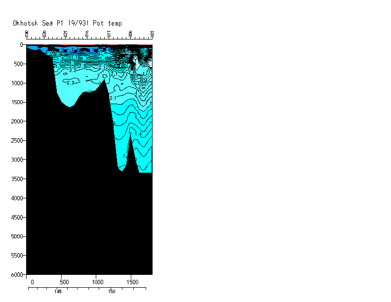
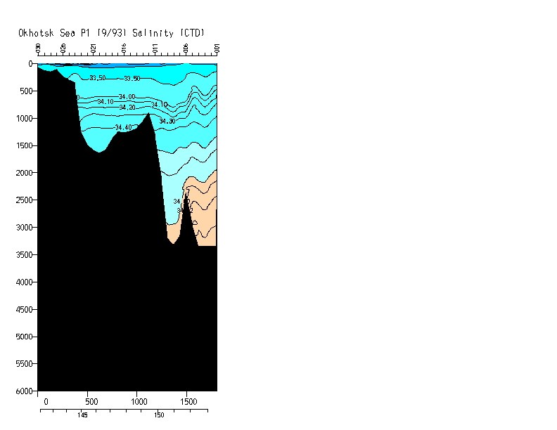
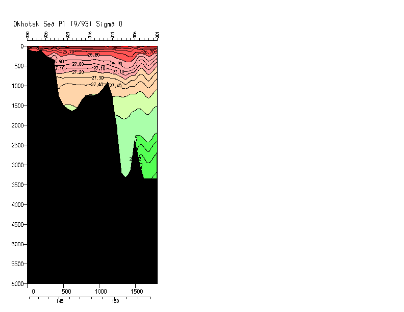
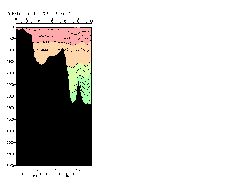
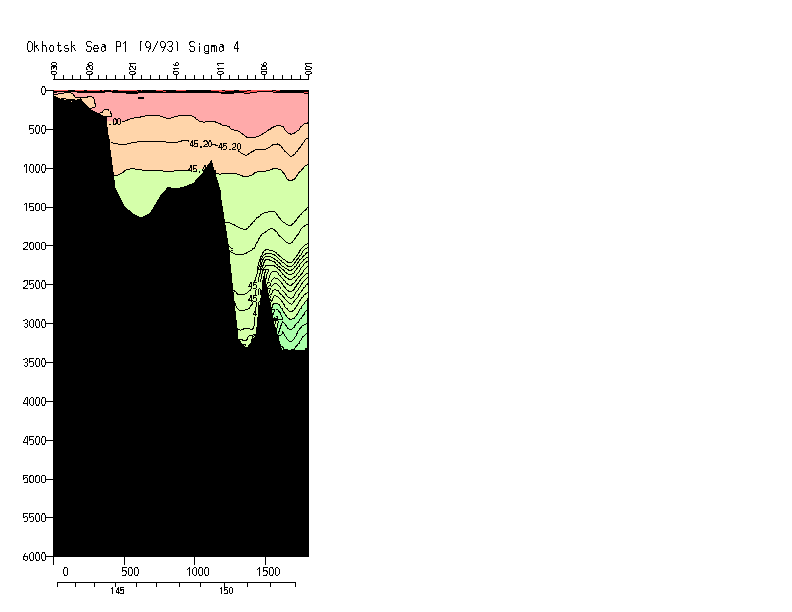
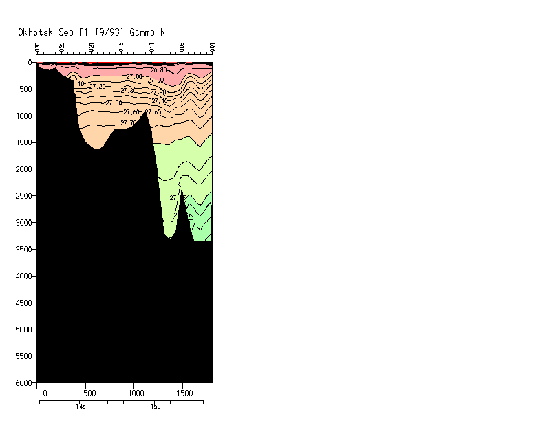
| P01W | Okhotsk Sea | Freeland/Wong |
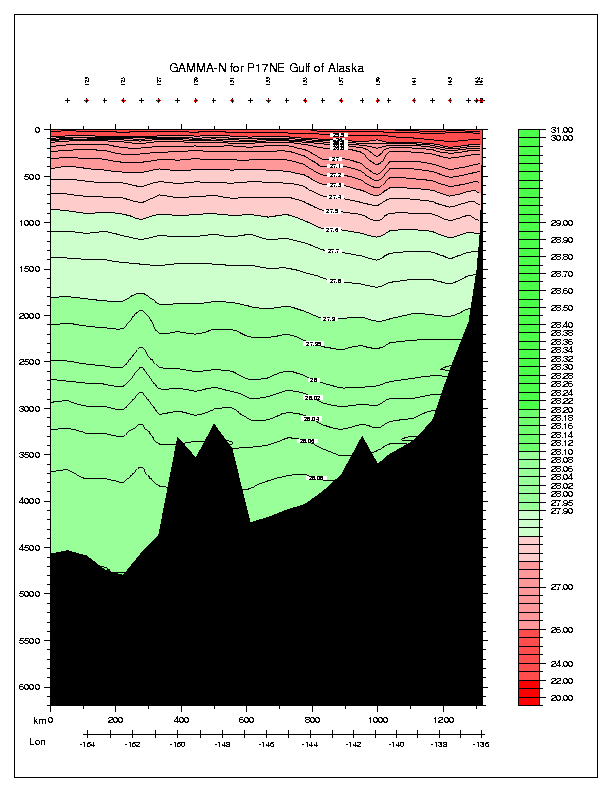
| P17NE | Gulf of Alaska | Musgrave |
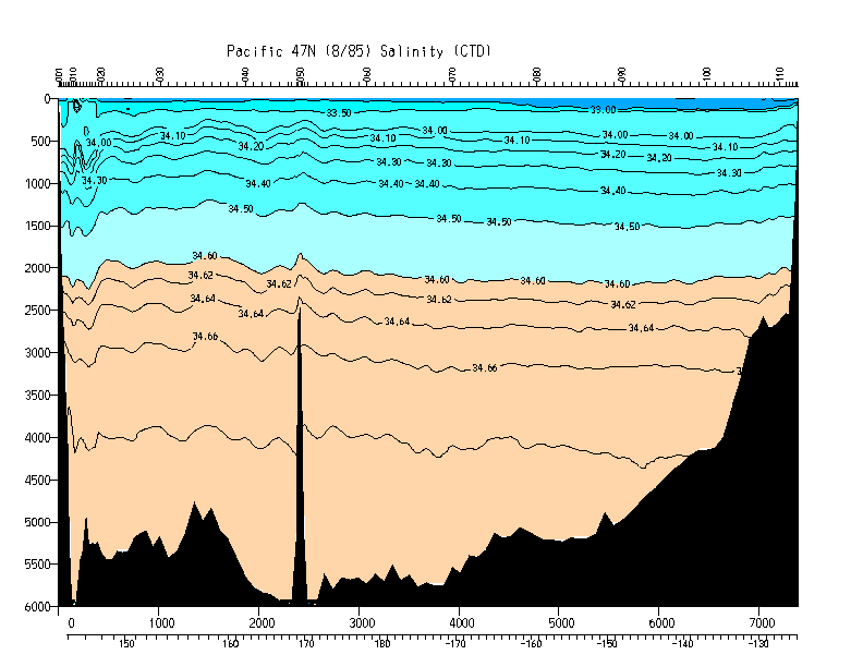
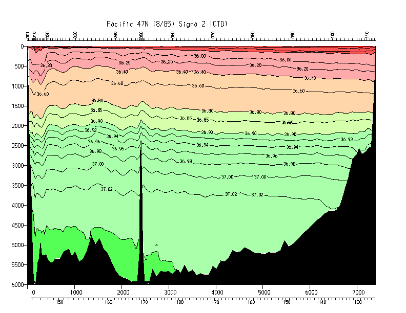
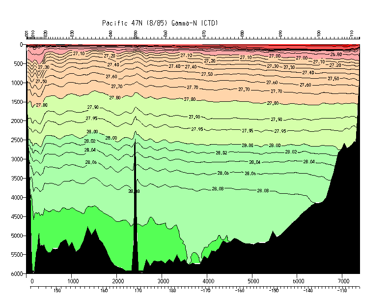
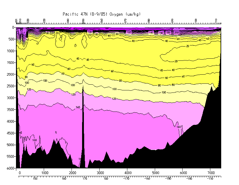
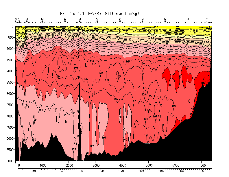
| P1_TPS47 | 47 N | Talley/Joyce |
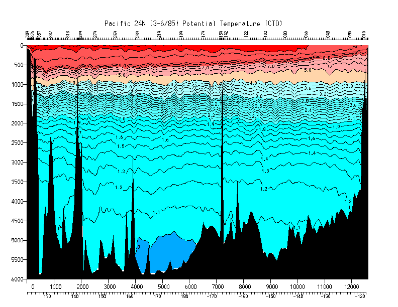
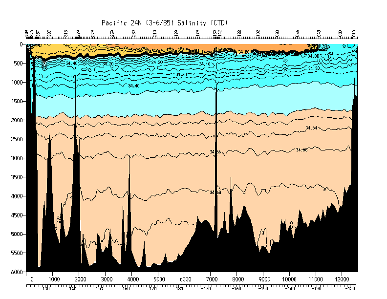
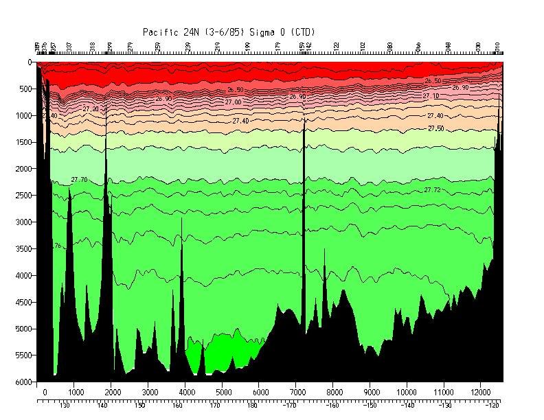
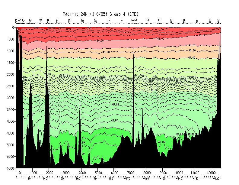
| P3_TPS24 | 24 N | Roemmich/Swift/Bryden |
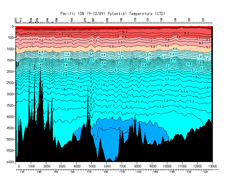
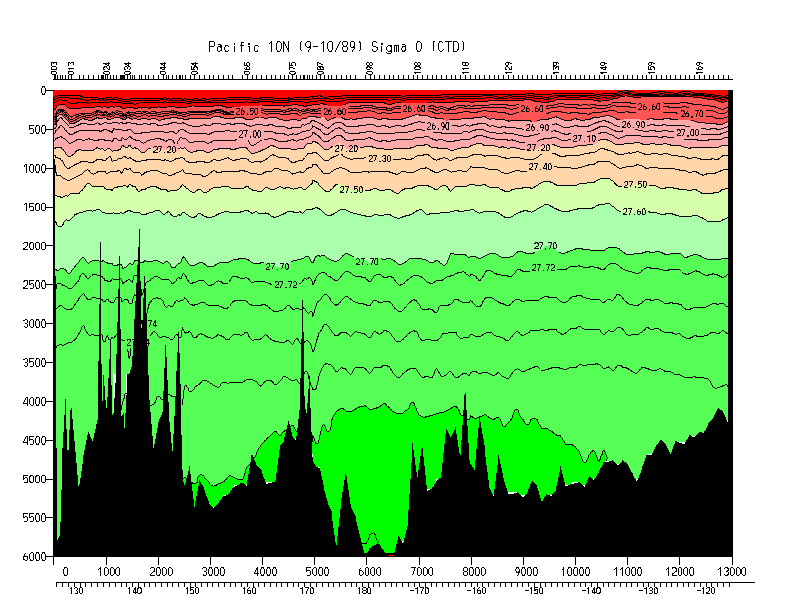
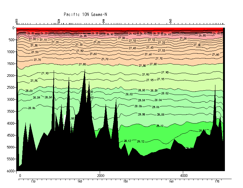
| P4_TPS10 | 10 N | Toole |
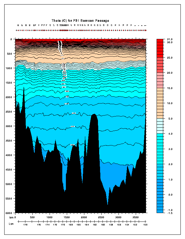
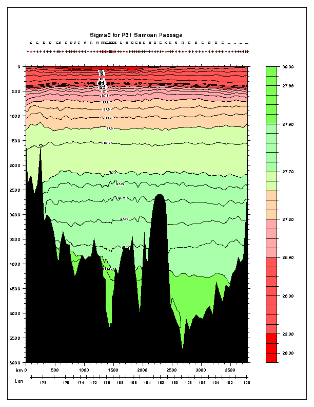
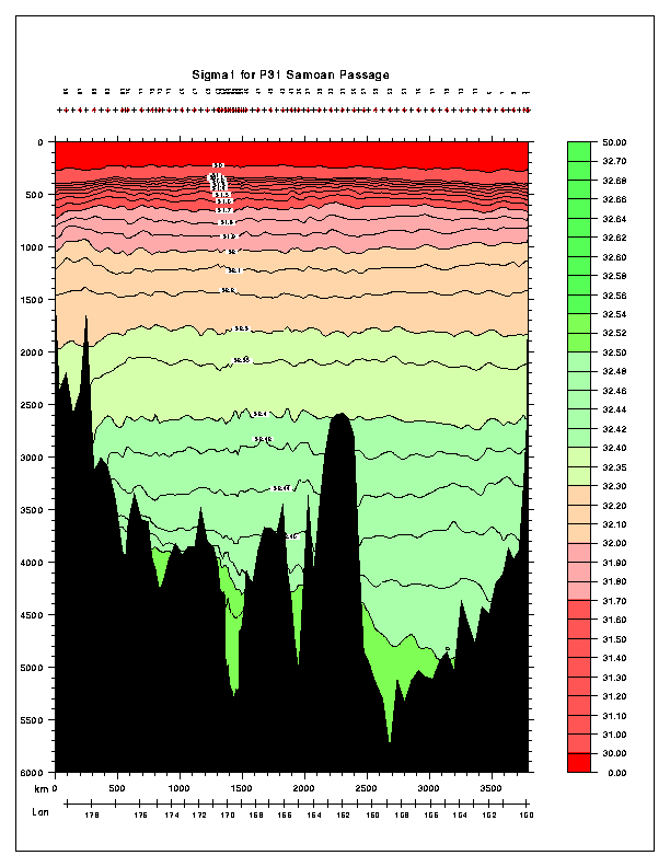
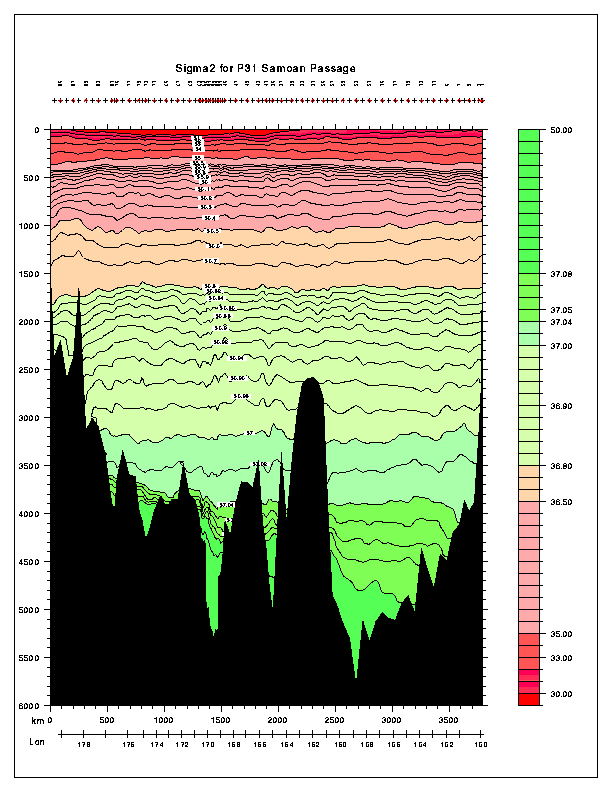
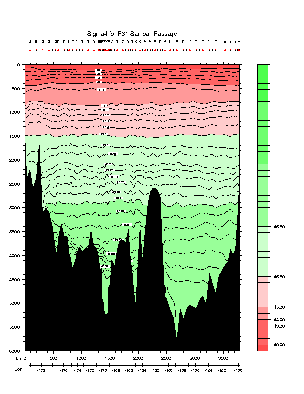
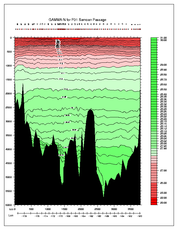
| P31 | Samoan Passage | Roemmich |
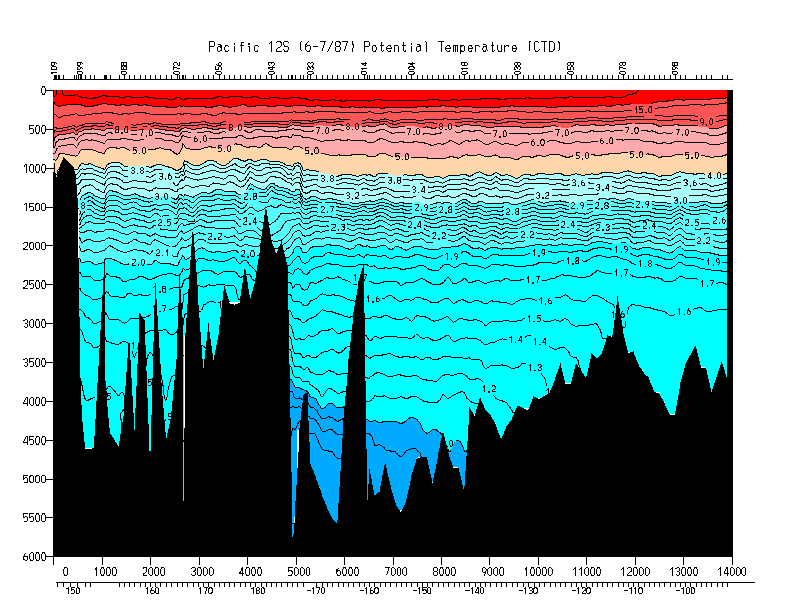
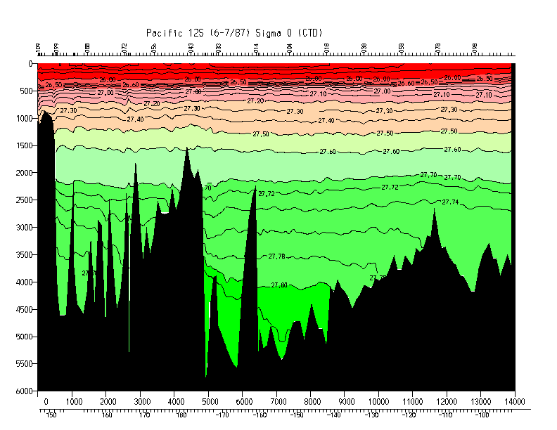
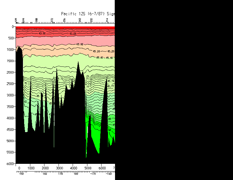
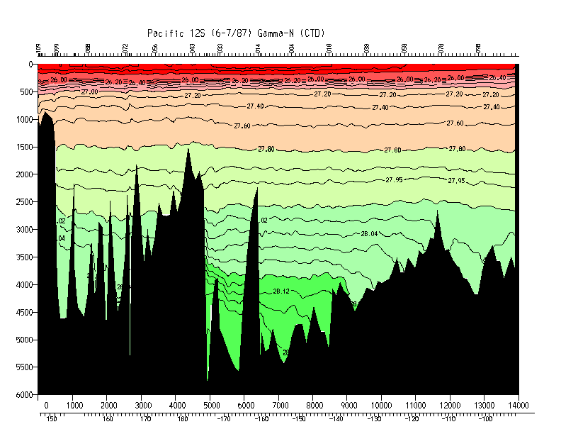
| TEW | 12 S | Hayes/Taft |
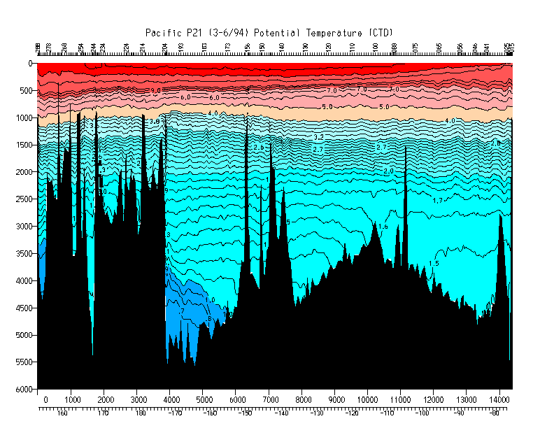
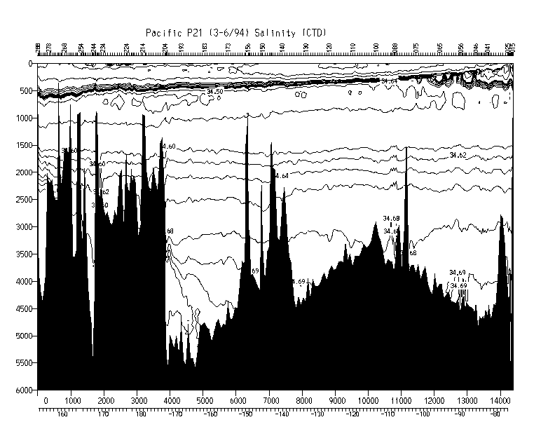
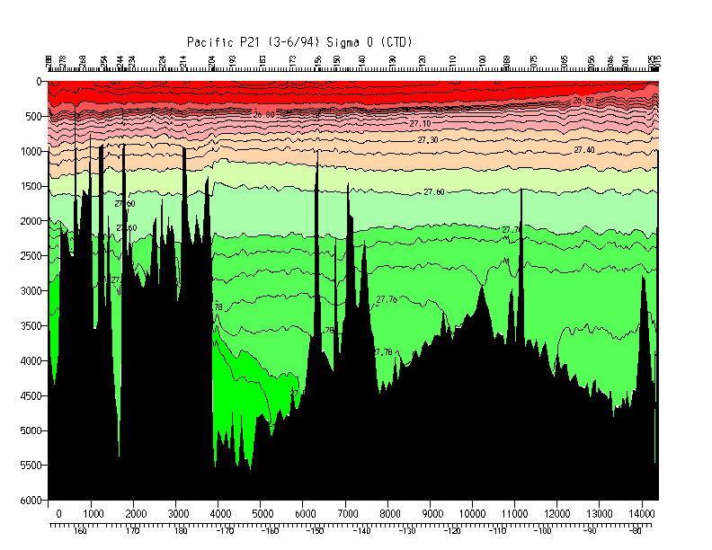
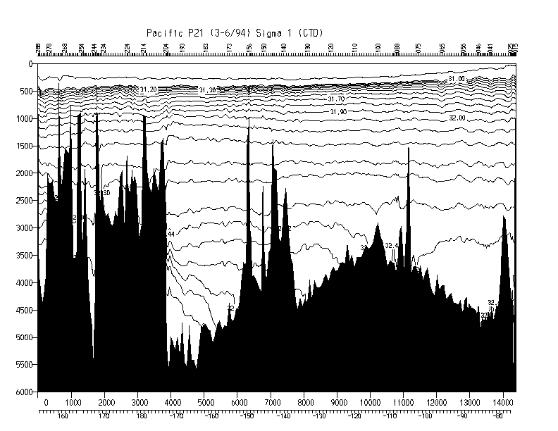
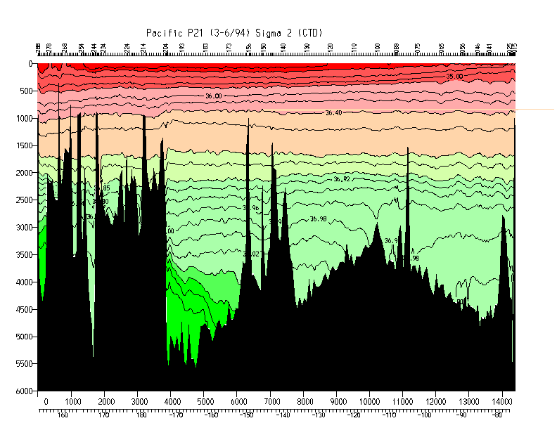
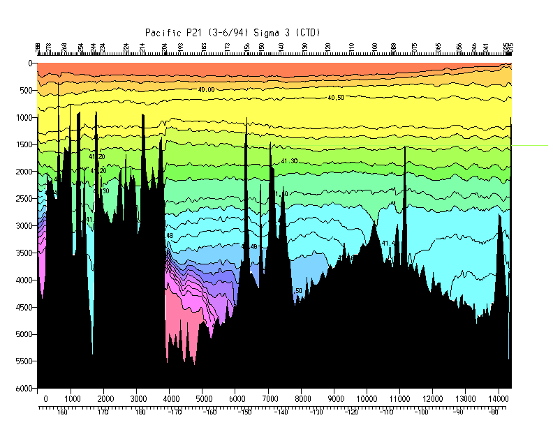
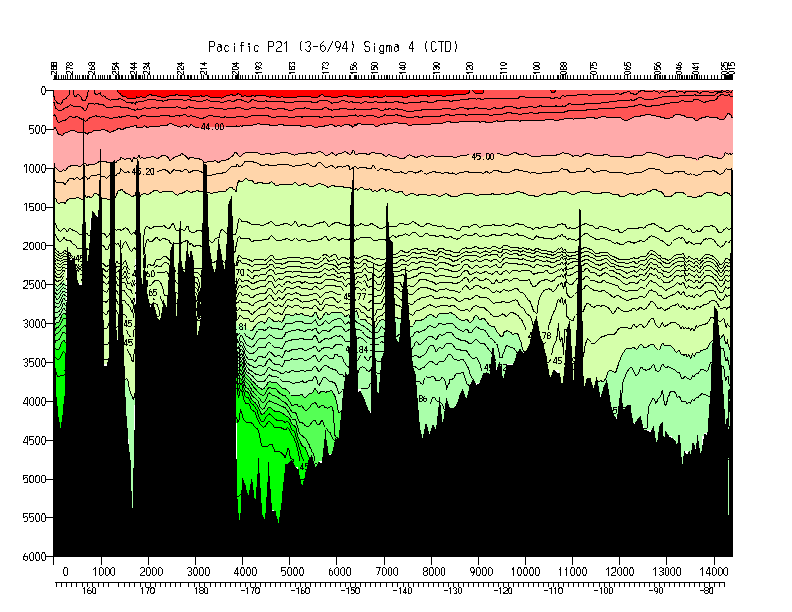
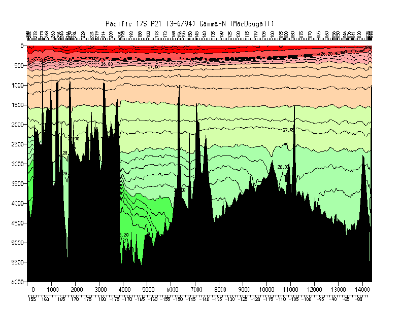
| P21 | 17 S | McCartney/Bryden |
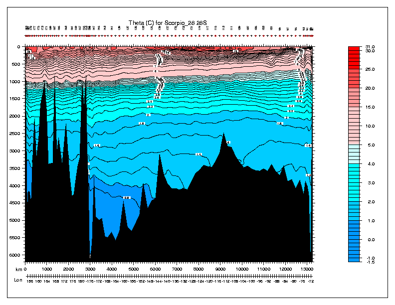
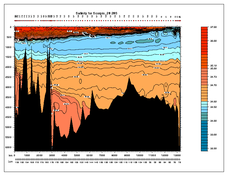
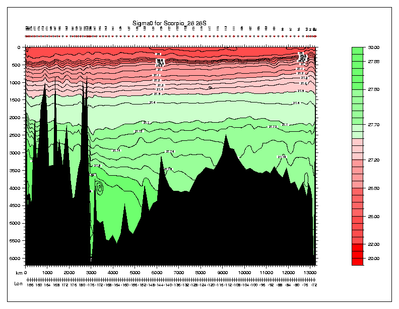
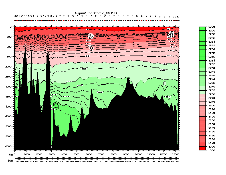
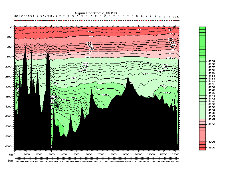
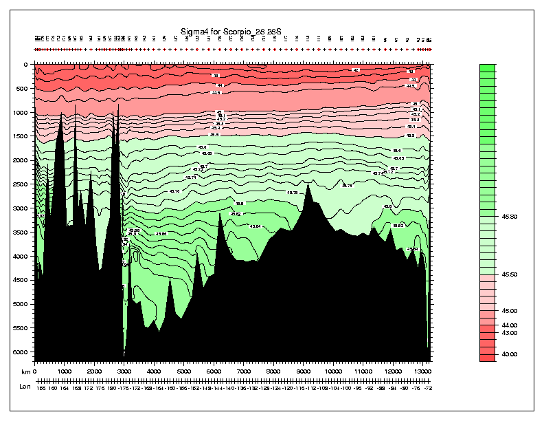
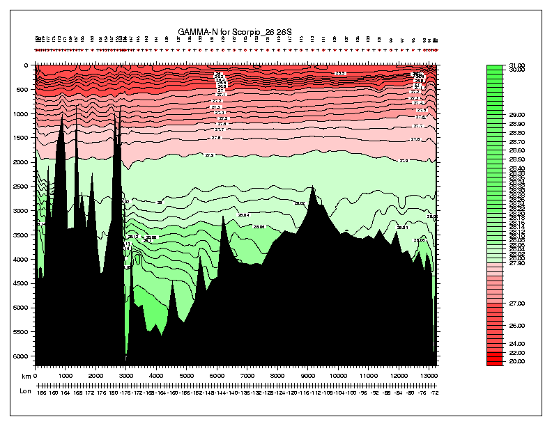
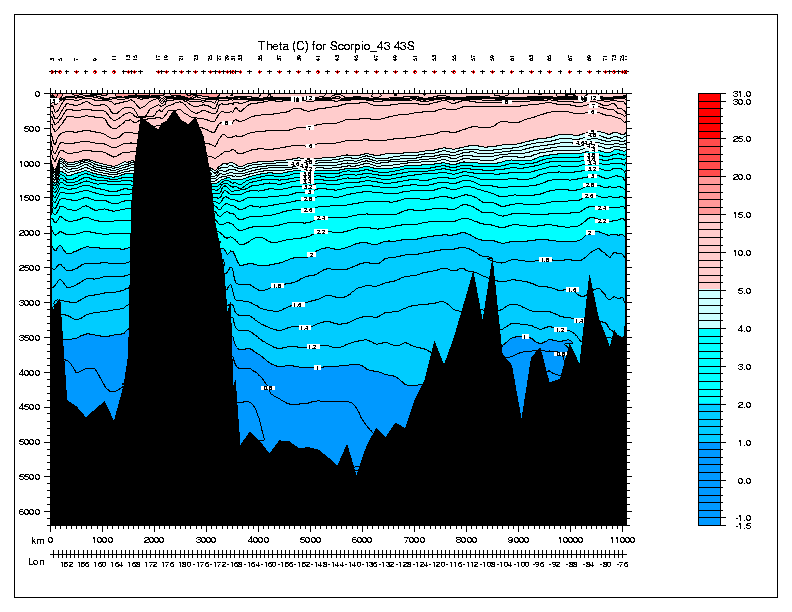
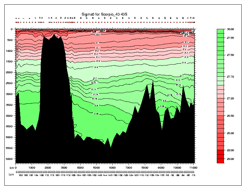
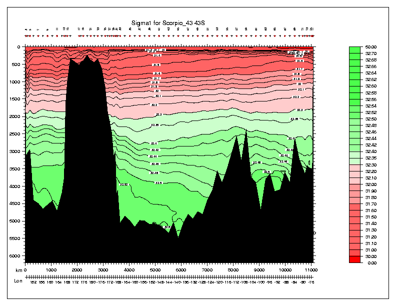
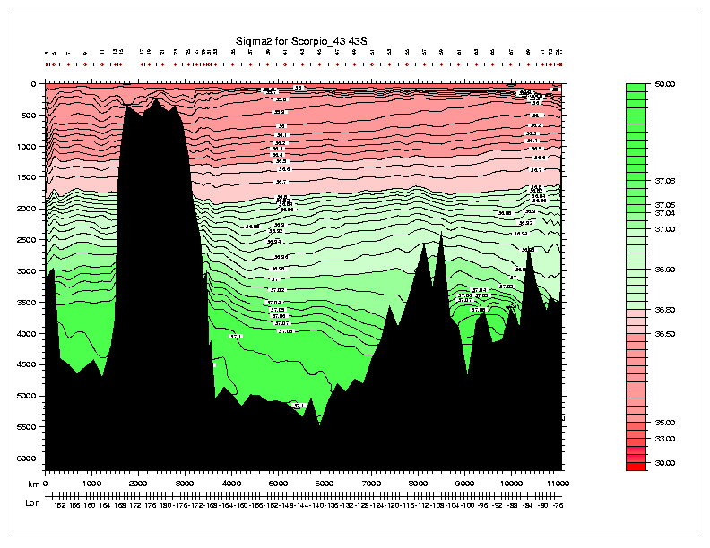
| Scorpio 28S | 28 S | Reid/Stommel/Warren |
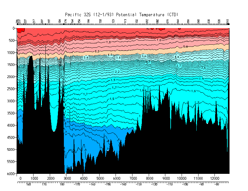
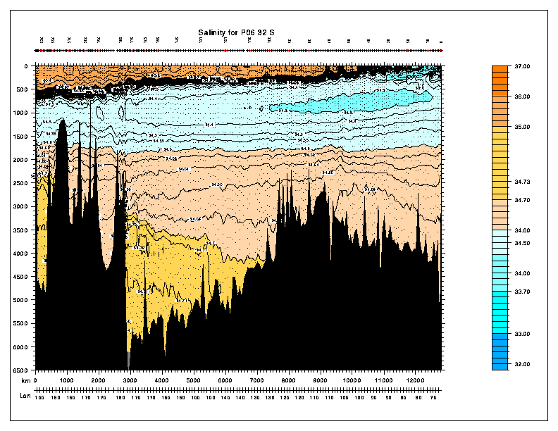
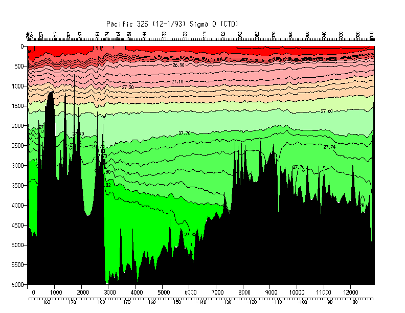
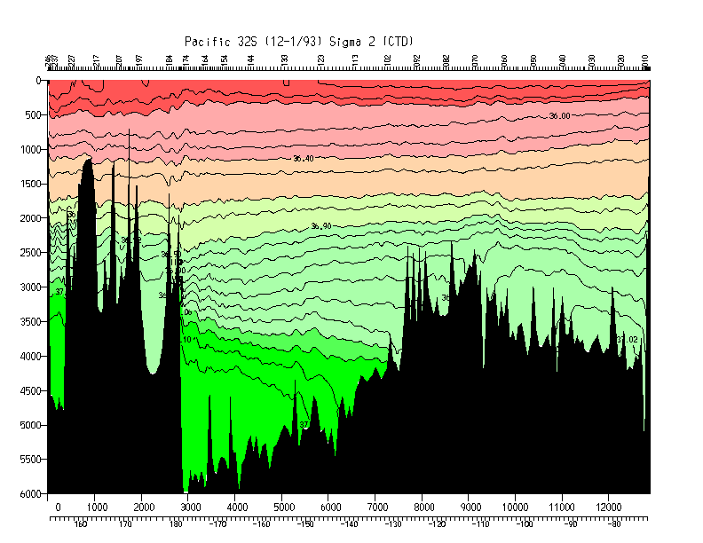
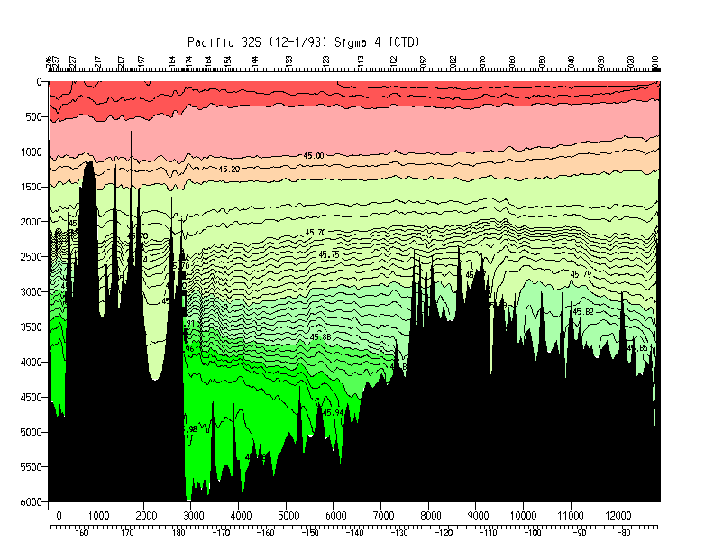
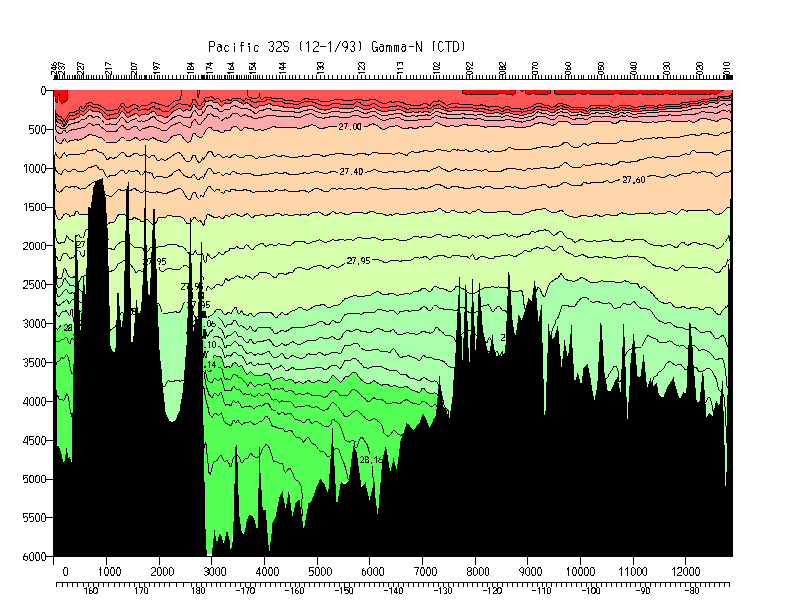
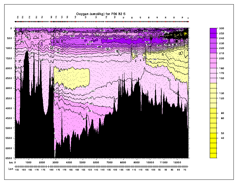
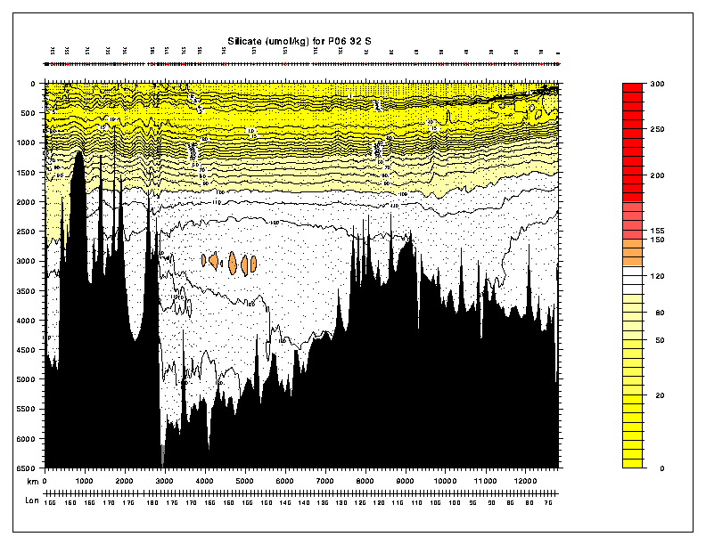
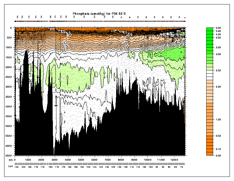
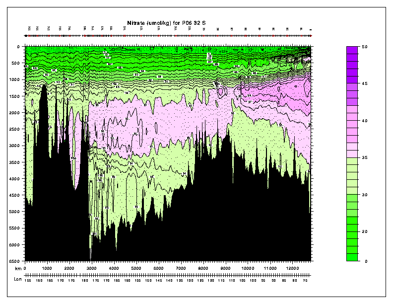
| P6 | 32 S | Bryden/McCartney/Toole |
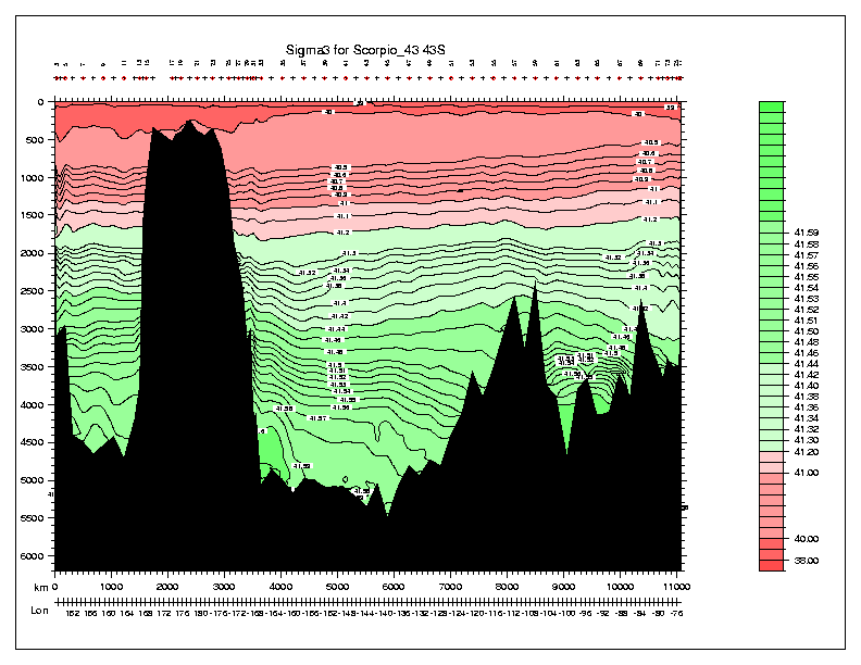
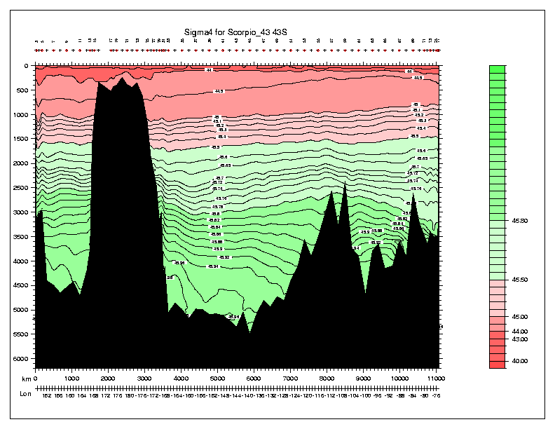
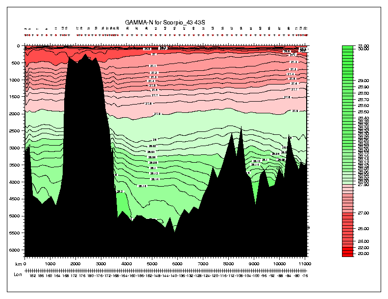
| Scorpio 43S | 43 S | Reid/Stommel/Warren |
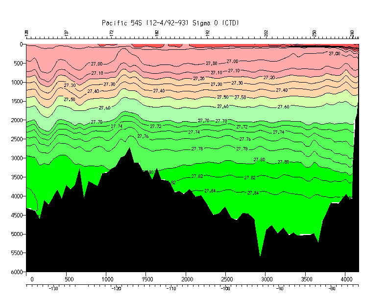
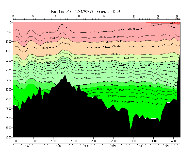
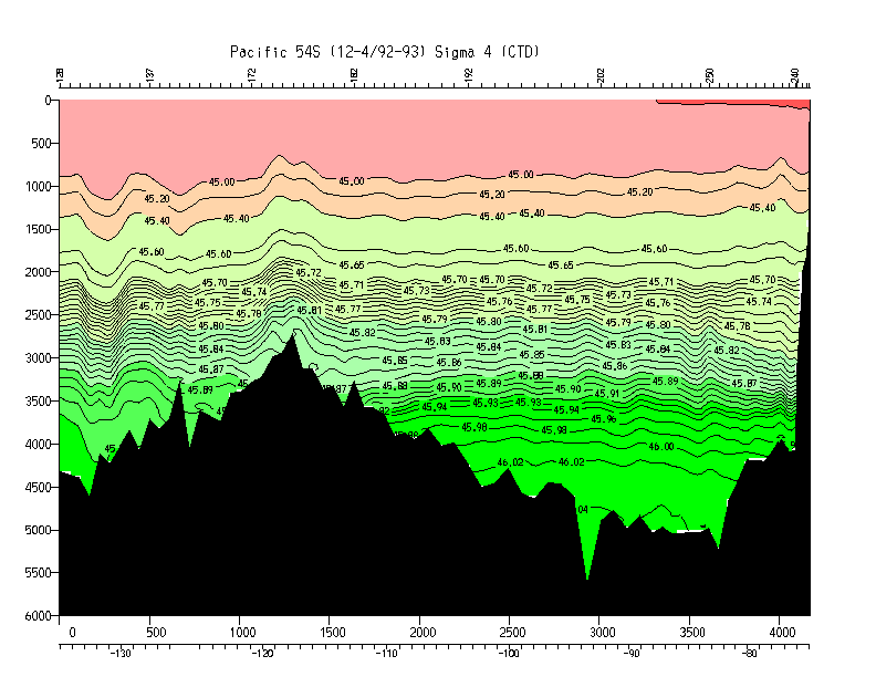
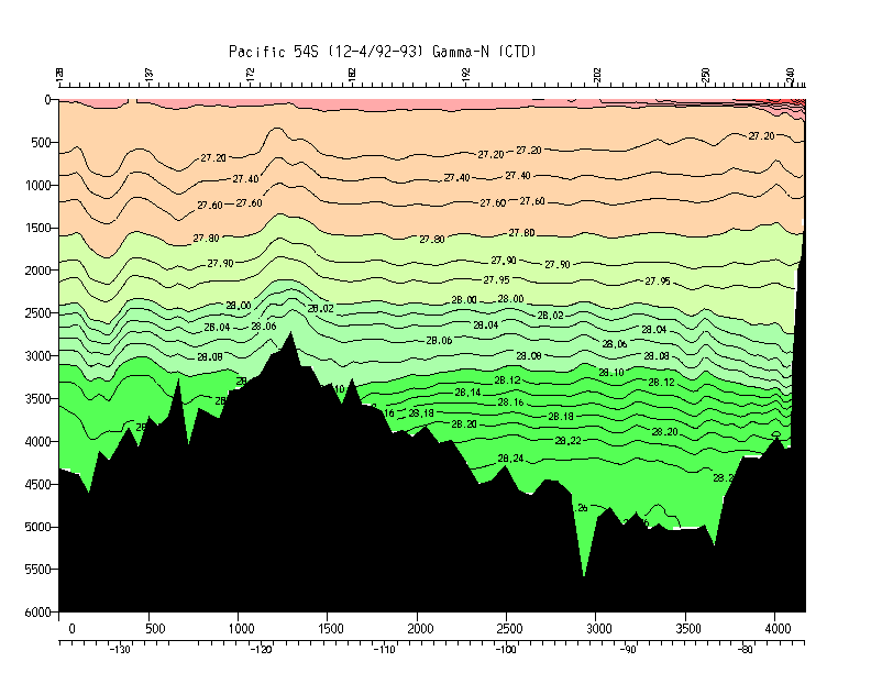
| P17E | 54 S | Swift/Talley |
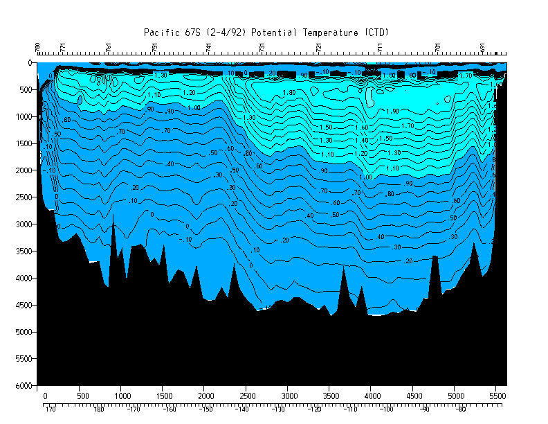
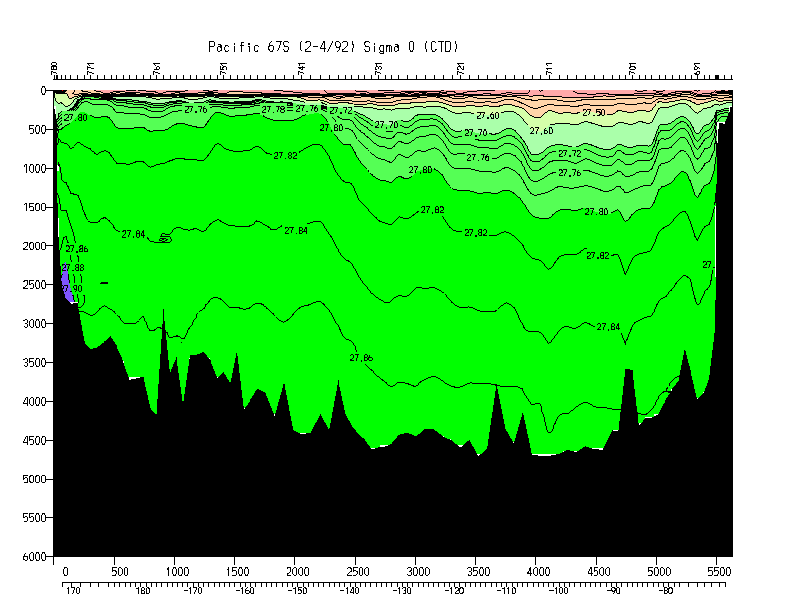
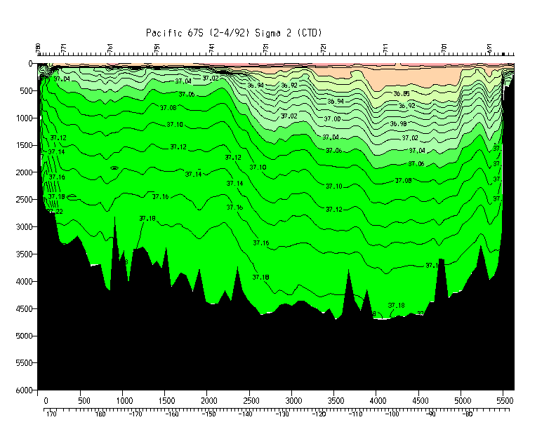
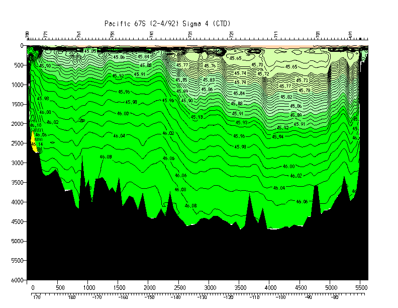
| S4 | 67 S | Swift |
| Line | Location | Chief Scientist |
|---|---|---|
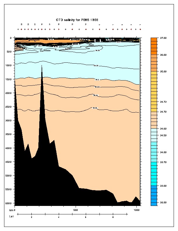
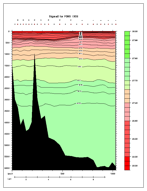
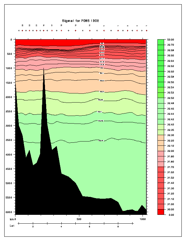
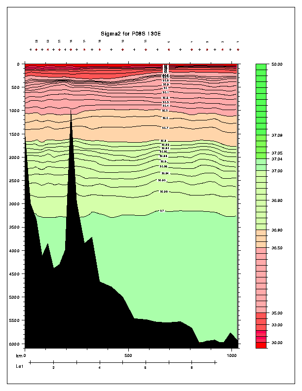
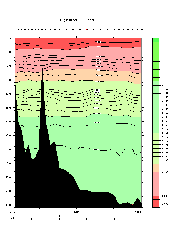
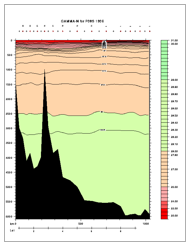
| P08 | 130E | Yoshioka/Mizuno |
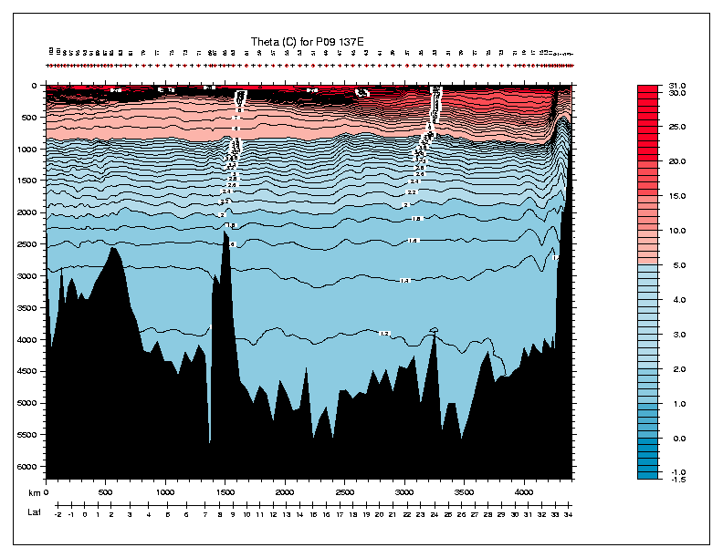
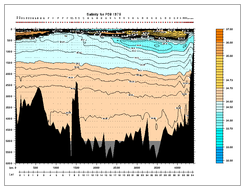
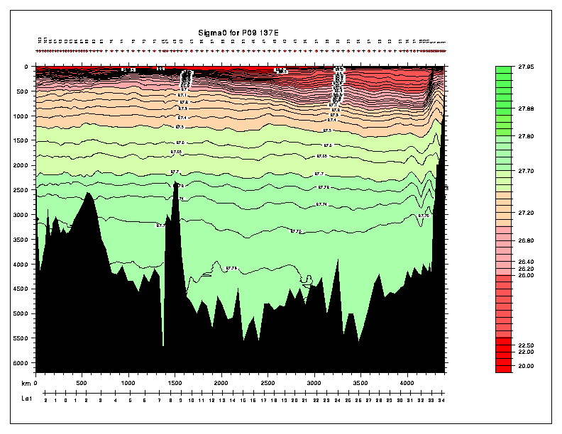
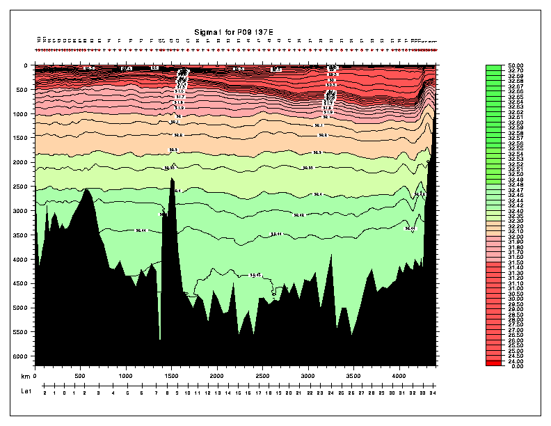
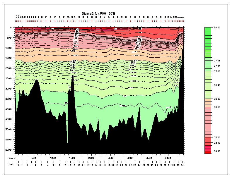
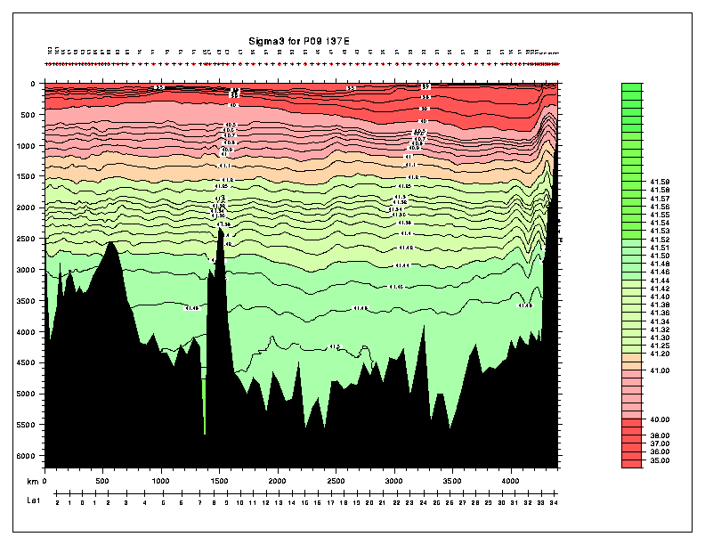
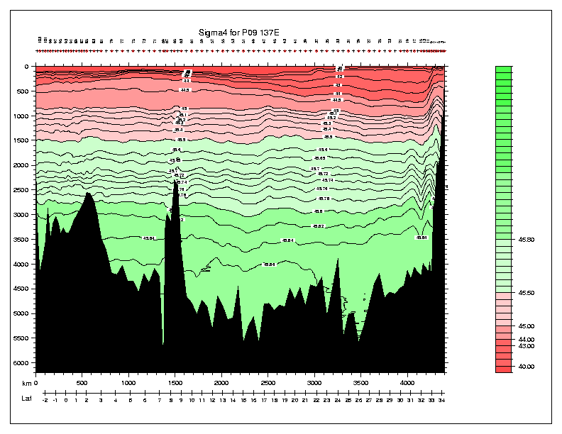
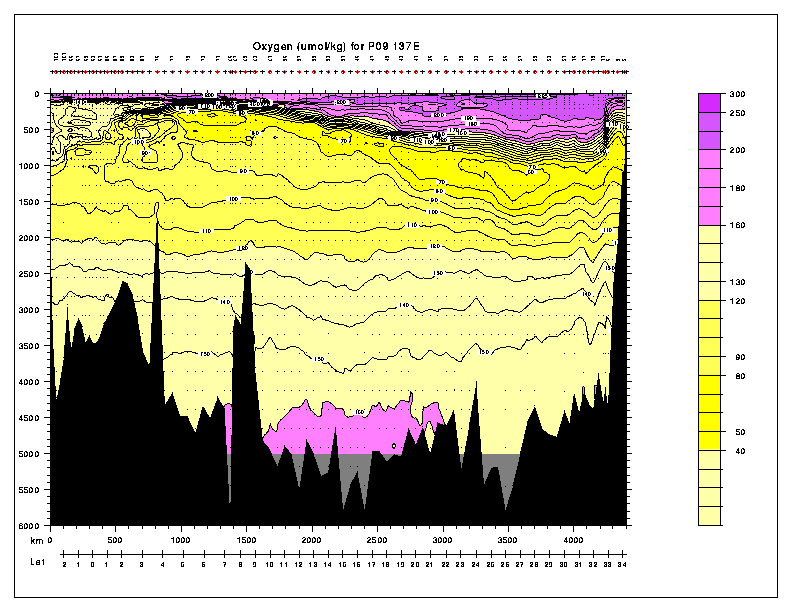
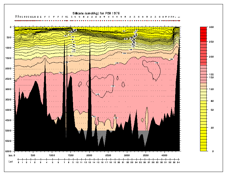
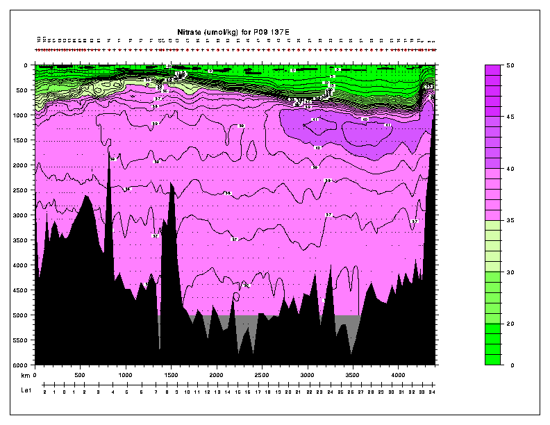
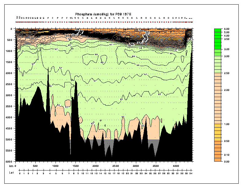
| P09 | 137 E | Kaneko |
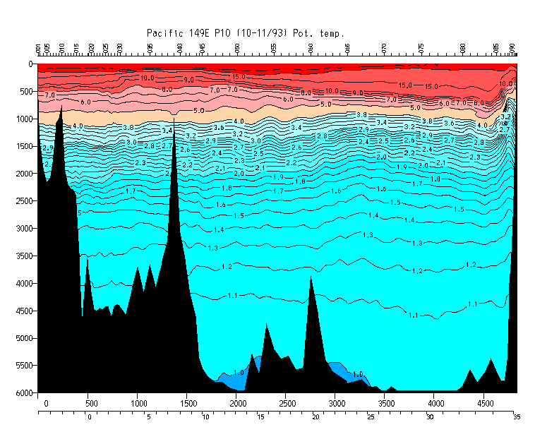
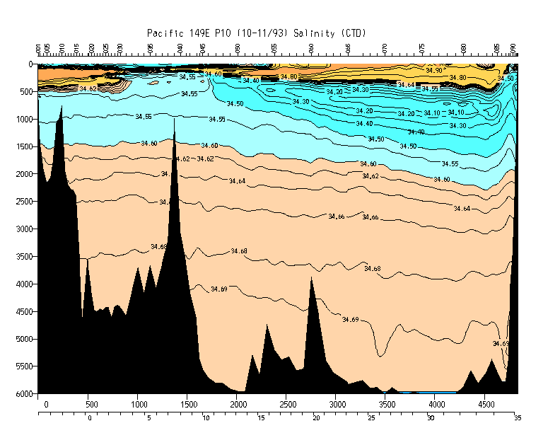
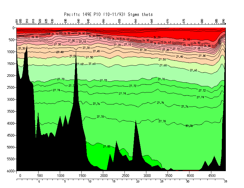
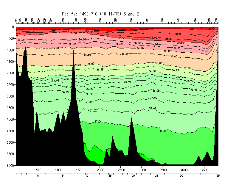
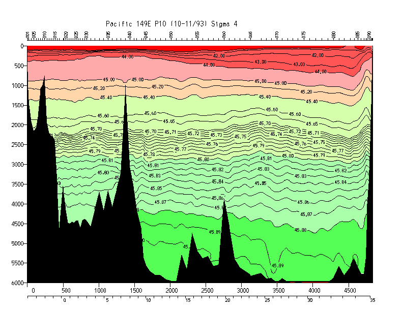
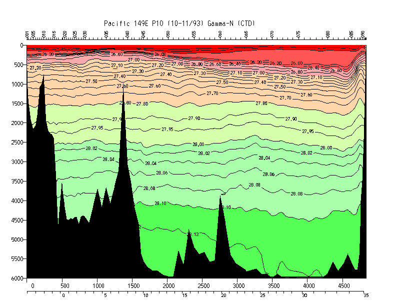
| P10 | 149 E | Hall/Joyce |
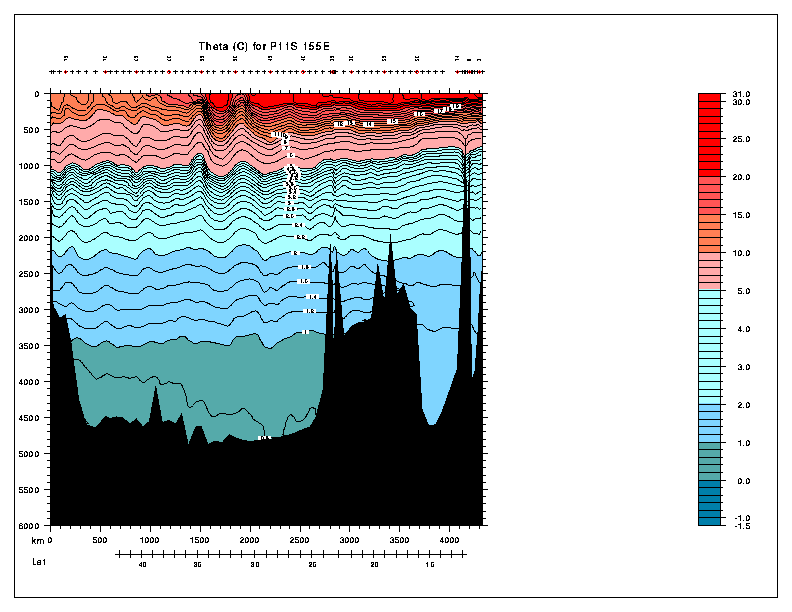
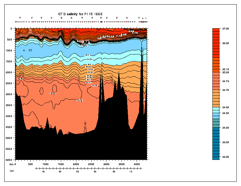
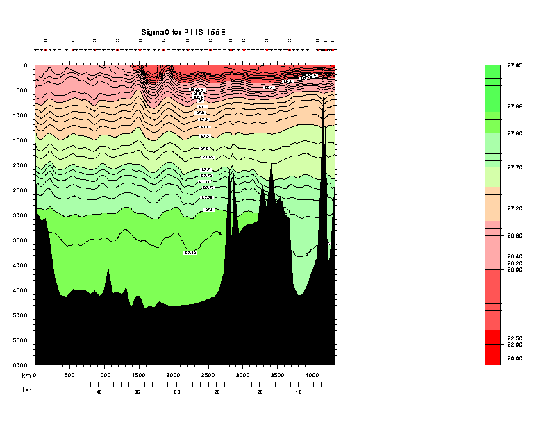
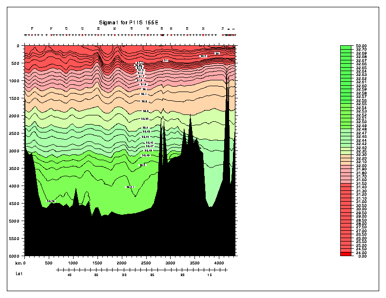
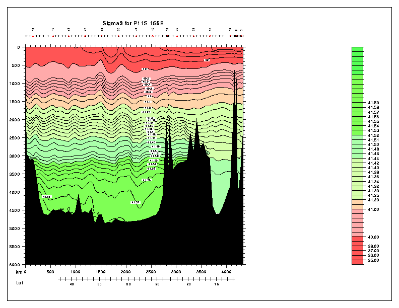
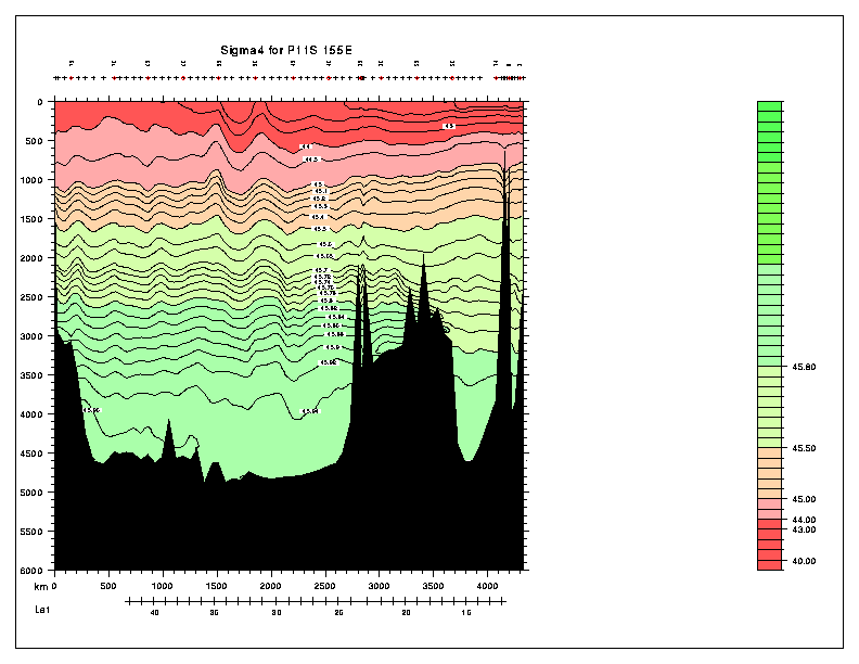
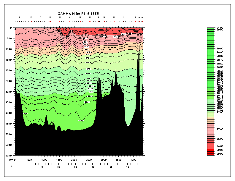
| P11S | 155 E | Church |
| P11A | 155 E | Rintoul |
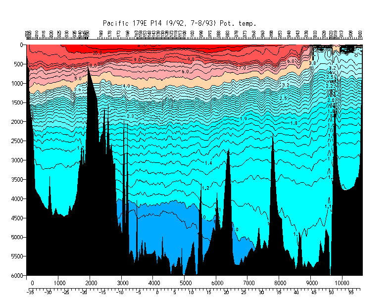
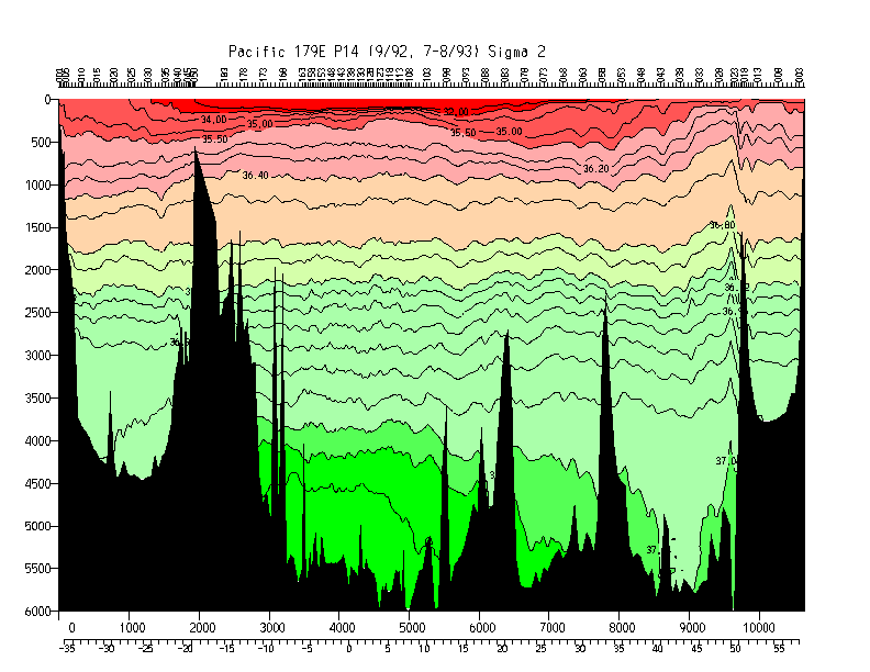
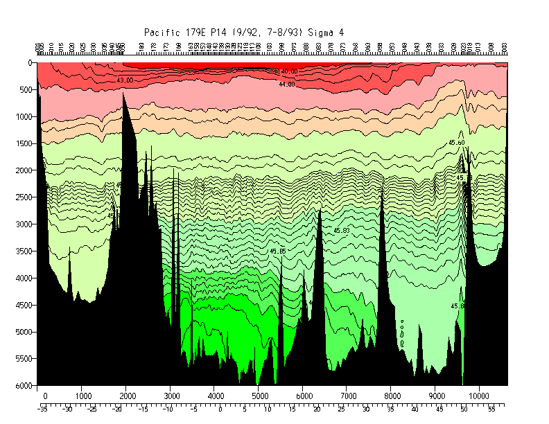
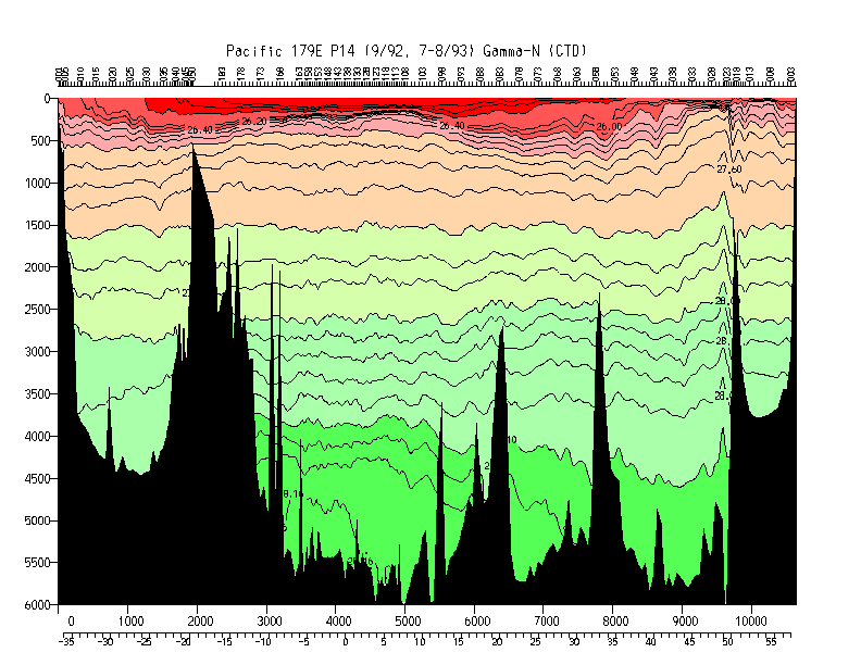
| P14 | 178 E | Roden/Roemmich |
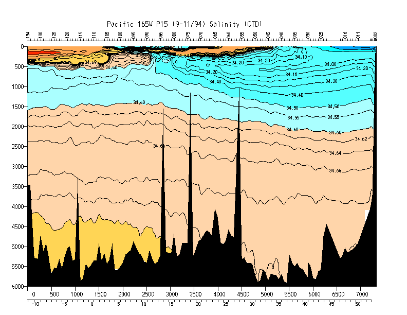
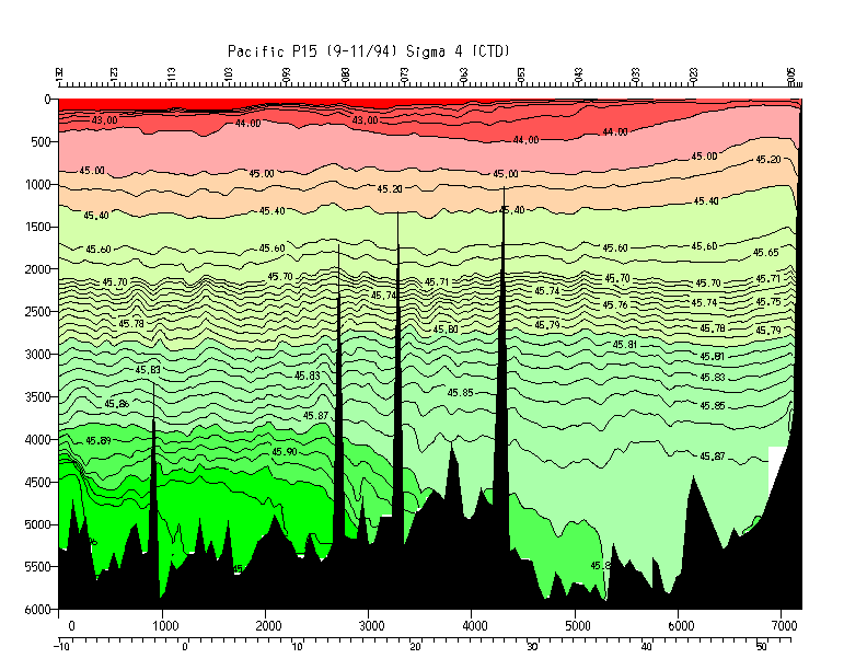
| P15N | 165 E | Freeland |
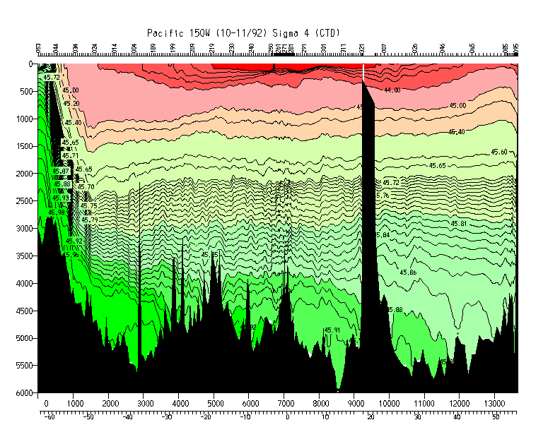
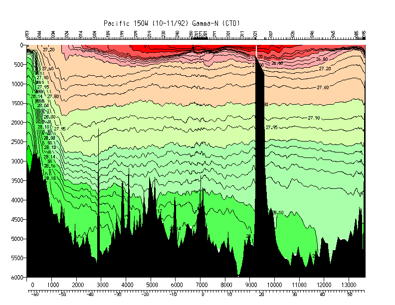
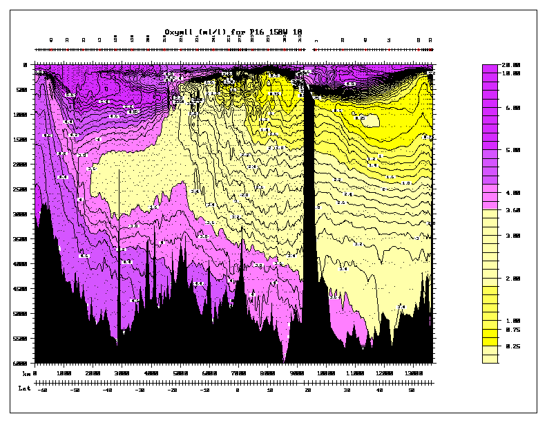
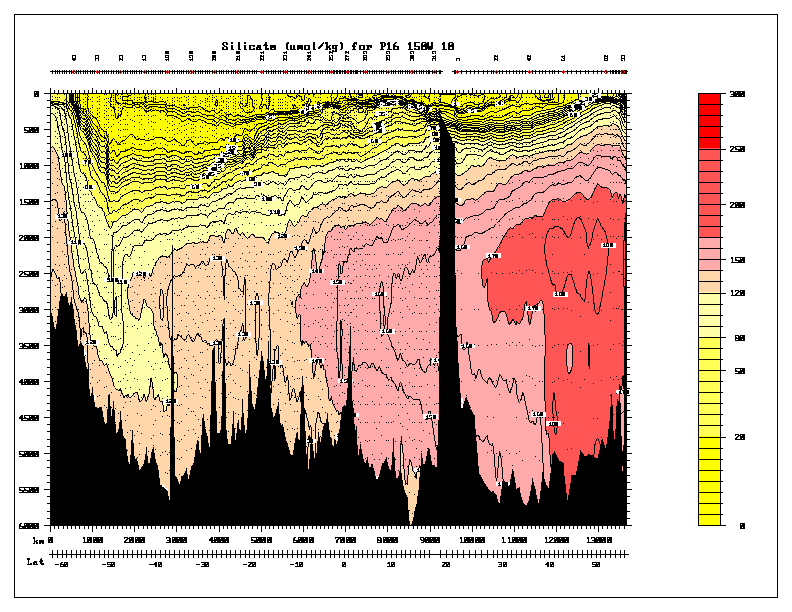
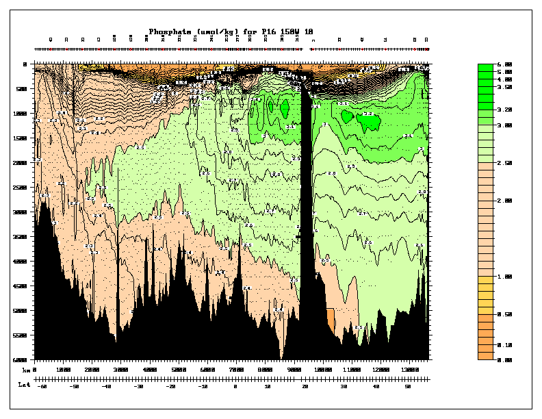
| P16 | 152 W | Reid/Swift/Talley |
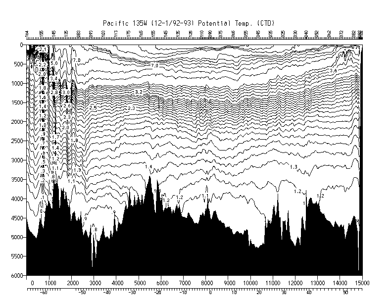
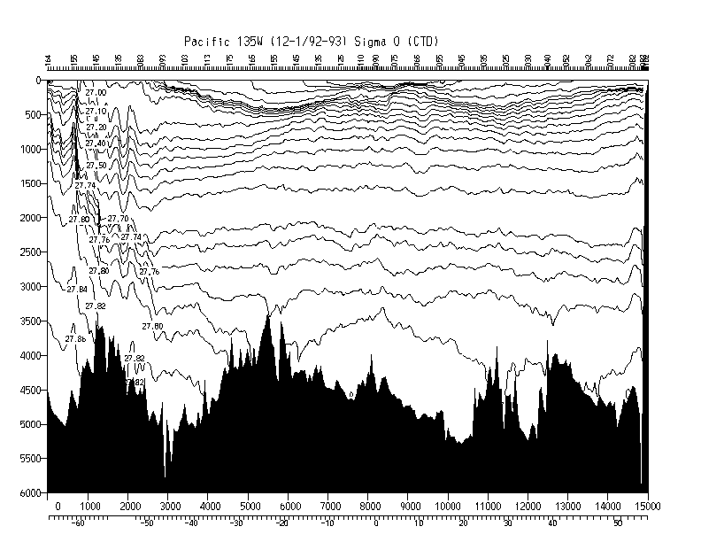
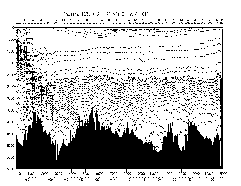
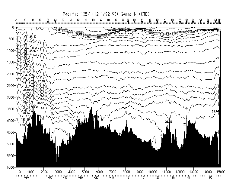
| P17 | 135 W | Swift/Tsuchiya/Musgrave |
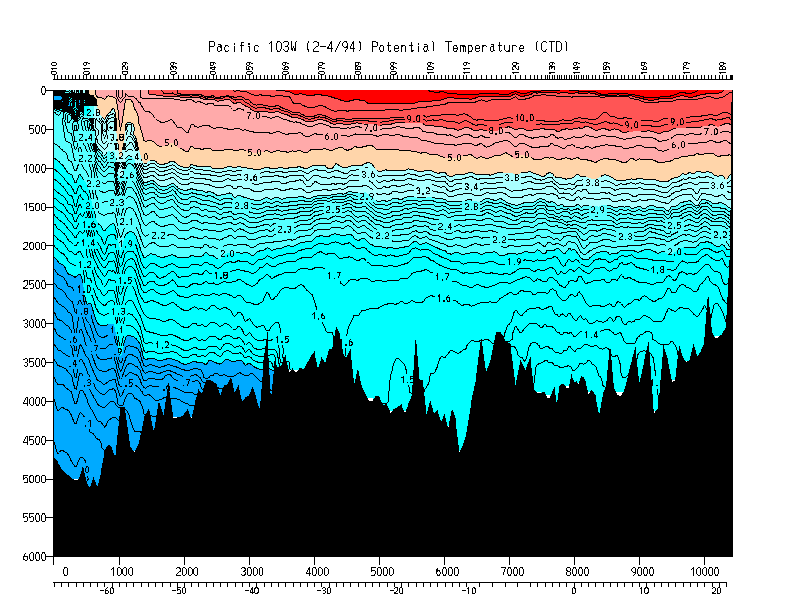
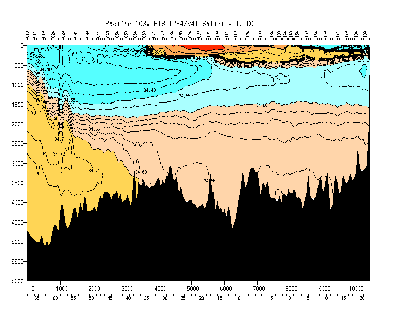
| P18 | 110 W | Johnson |
| P19 | 88 W | Swift/Talley |
Plots are available online in gif format; postscript versions can also be downloaded. BUG: as of 8/15/96, the maximum length for the plots is 14000 km, so some sections are missing the eastern or northern end or are in black and white. (Affected sections are: TPS10, TEW, P21, and P17.) The gridded files go completely to the coast on each end - they are not missing any positions.
WOCE Hydrographic Programme Office
WOCE Data Information Unit hydrographic data page
WHP Special Analysis Centre
nemo WHP SAC mirror site at SIO
U.S. WOCE Homepage
nemo oceanographic data server at SIO
Scripps Institution of Oceanography local servicees
| Property | gif plot | postscript file | 20x40 grid | 20x10 grid |
|---|---|---|---|---|
| Temperature | N | N | Y | Y |
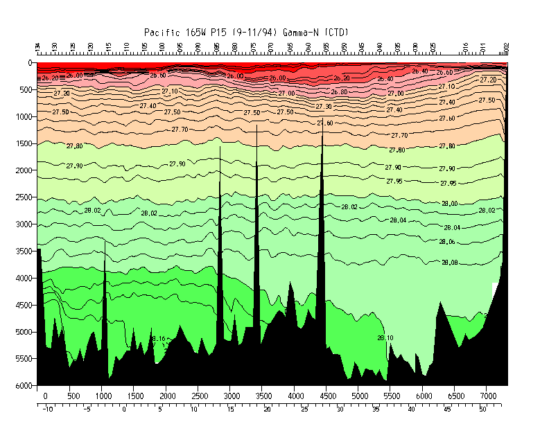
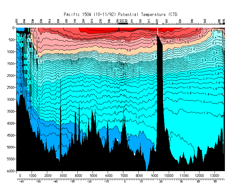
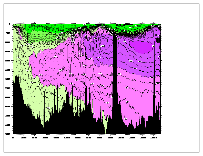
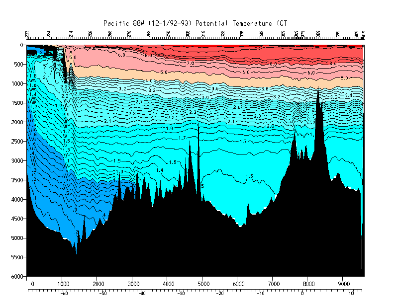
| Potential temperature | Y | Y | Y | Y |
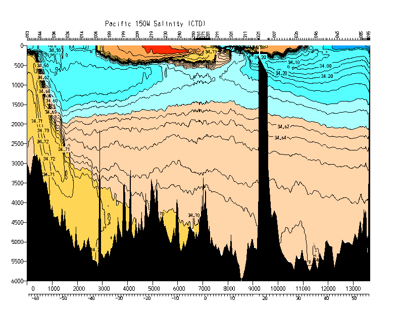
| Salinity | Y | Y | Y | Y |
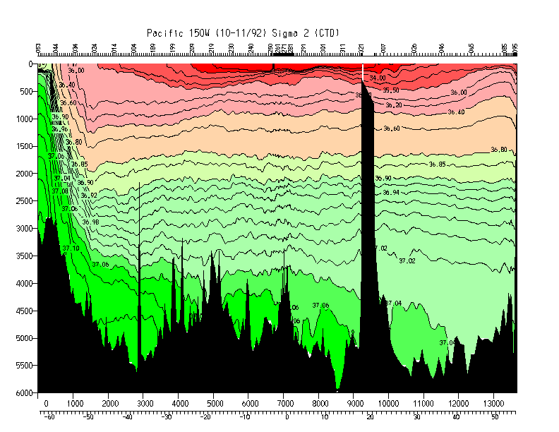
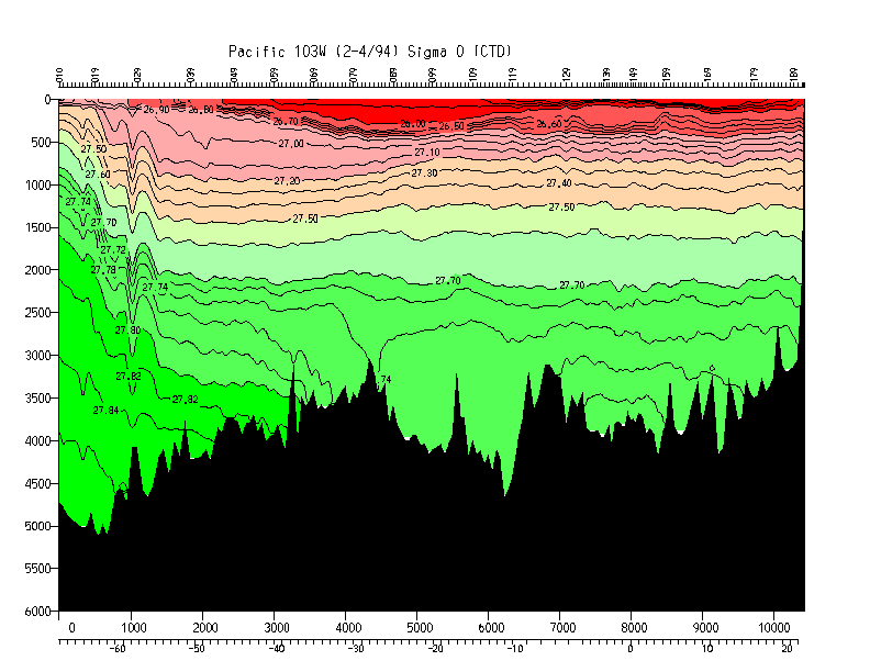
| Potential density (0) | Y | Y | Y | Y |
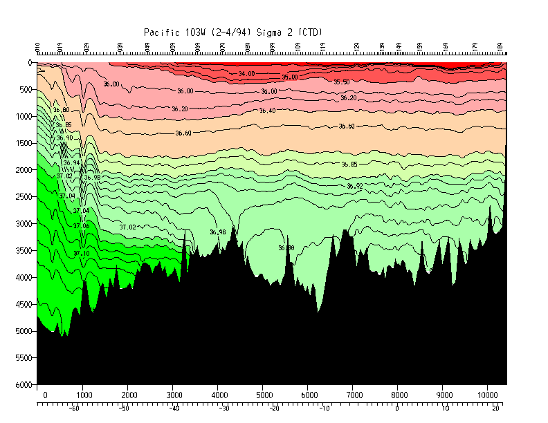
| Potential density (2000) | Y | Y | Y | Y |
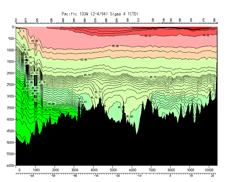
| Potential density (4000) | Y | Y | Y | Y |
| Neutral density (McDougall) | Y | Y | Y | Y |
| Error map | N | N | Y | Y |
Note: all gridded files are binary.
Click here
for instructions on format and fortran programs for reading the
header information and data.
| Property | gif plot | postscript file | 10x10 grid |
|---|---|---|---|
| Temperature | N | N | N |
| Potential temperature | Y | Y | Y |
| CTD Salinity | Y | Y | Y |
| Potential density (0) | Y | Y | Y |
| Potential density (1000) | Y | Y | Y |
| Potential density (2000) | Y | Y | Y |
| Potential density (3000) | Y | Y | Y |
| Potential density (4000) | Y | Y | Y |
| Neutral density (McDougall) | Y | Y | Y |
Note: all gridded files are binary.
Click here
for instructions on format and fortran programs for reading the
header information and data.
| Property | gif plot | postscript file | 20x40 grid | 20x10 grid |
|---|---|---|---|---|
| Temperature | N | N | Y | Y |
| Potential temperature | Y | Y | Y | Y |
| Salinity | Y | Y | Y | Y |
| Potential density (0) | Y | Y | Y | Y |
| Potential density (2000) | Y | Y | Y | Y |
| Potential density (4000) | Y | Y | Y | Y |
| Neutral density (McDougall) | Y | Y | Y | Y |
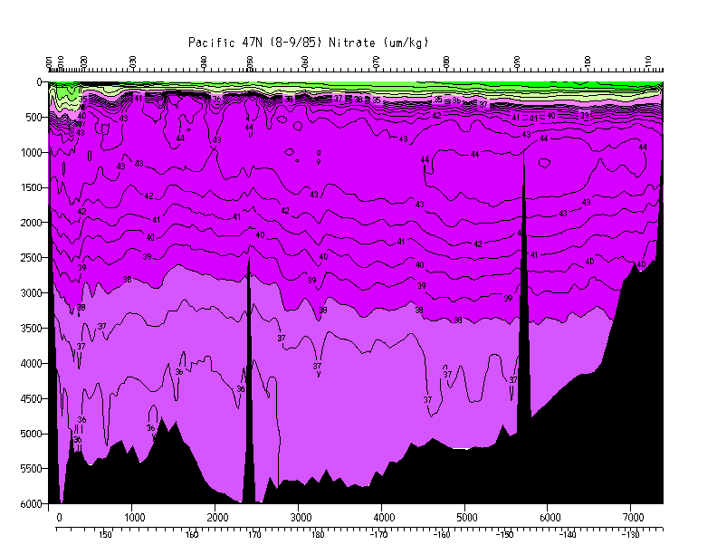
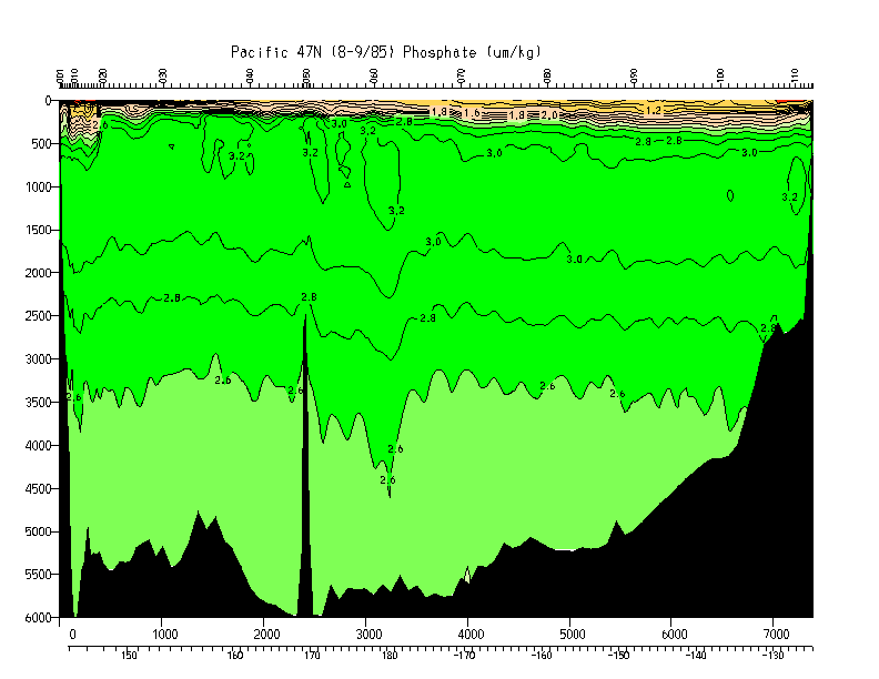
| Oxygen (umol/kg) | Y | Y | N | Y |
| Silicate (umol/kg) | Y | Y | N | Y |
| Nitrate (umol/kg) | Y | Y | N | Y |
| Phosphate (umol/kg) | Y | Y | N | Y |
| Error map | N | N | Y | Y |
Note: all gridded files are binary.
47N station and bottle position information files
(latitude/longitude, distance along the section, and bottle
positions of good data for each station).
P1_TPS47 flat ascii bottle data file
Click here
for instructions on format and fortran programs for reading the
header information and data and writing them in ascii.
| Property | gif plot | postscript file | 20x40 grid | 20x10 grid |
|---|---|---|---|---|
| Temperature | N | N | Y | Y |
| Potential temperature | Y | Y | Y | Y |
| Salinity | Y | Y | Y | Y |
| Potential density (0) | Y | Y | Y | Y |
| Potential density (2000) | Y | Y | Y | Y |
| Potential density (4000) | Y | Y | Y | Y |
| Neutral density (McDougall) | Y | Y | Y | Y |
| Error map | N | N | Y | Y |
Note: all gridded files are binary.
Click here
for instructions on format and fortran programs for reading the
header information and data.
| Property | gif plot | postscript file | 20x40 grid | 20x10 grid |
|---|---|---|---|---|
| Temperature | N | N | Y | Y |
| Potential temperature | Y | Y | Y | Y |
| Salinity | Y | Y | Y | Y |
| Potential density (0) | Y | Y | Y | Y |
| Potential density (2000) | Y | Y | Y | Y |
| Potential density (4000) | Y | Y | Y | Y |
| Neutral density (McDougall) | Y | Y | Y | Y |
| Error map | N | N | Y | Y |
Note: all gridded files are binary.
Click here
for instructions on format and fortran programs for reading the
header information and data.
The plots (but not the gridded files) are truncated at the eastern end
because of a plotting problem associated with the great length of
the sections.
| Property | gif plot | postscript file | 10x10 grid |
|---|---|---|---|
| Temperature | N | N | N |
| Potential temperature | Y | Y | Y |
| CTD Salinity | Y | Y | Y |
| Potential density (0) | Y | Y | Y |
| Potential density (1000) | Y | Y | Y |
| Potential density (2000) | Y | Y | Y |
| Potential density (3000) | Y | Y | Y |
| Potential density (4000) | Y | Y | Y |
| Neutral density (McDougall) | Y | Y | Y |
Note: all gridded files are binary.
Click here
for instructions on format and fortran programs for reading the
header information and data.
| Property | gif plot | postscript file | 20x40 grid | 20x10 grid |
|---|---|---|---|---|
| Temperature | N | N | Y | Y |
| Potential temperature | Y | Y | Y | Y |
| Salinity | Y | Y | Y | Y |
| Potential density (0) | Y | Y | Y | Y |
| Potential density (2000) | Y | Y | Y | Y |
| Potential density (4000) | N | Y | Y | Y |
| Neutral density (McDougall) | Y | Y | Y | Y |
| Error map | N | N | Y | Y |
Note: all gridded files are binary.
Click here
for instructions on format and fortran programs for reading the
header information and data.
The plots (but not the gridded files) are truncated at the eastern end
because of a plotting problem associated with the great length of
the sections.
| Property | gif plot | postscript file | 20x40 grid | 20x10 grid |
|---|---|---|---|---|
| Temperature | N | N | N | N |
| Potential temperature | Y | Y | Y | Y |
| Salinity | Y | Y | Y | Y |
| Potential density (0) | Y | Y | Y | Y |
| Potential density (1000) | Y | Y | Y | Y |
| Potential density (2000) | Y | Y | Y | Y |
| Potential density (3000) | Y | Y | Y | Y |
| Potential density (4000) | Y | Y | Y | Y |
| Neutral density (McDougall) | Y | Y | Y | Y |
| Error map | N | N | Y | Y |
Note: all gridded files are binary.
Click here
for instructions on format and fortran programs for reading the
header information and data.
The plots are truncated at the eastern end because of a plotting bug
associated with the great length of the section.
| Property | gif plot | postscript file | 10x10 grid |
|---|---|---|---|
| Potential temperature | Y | Y | Y |
| Salinity | Y | Y | Y |
| Potential density (0) | Y | Y | Y |
| Potential density (1000) | Y | Y | Y |
| Potential density (2000) | Y | Y | Y |
| Potential density (3000) | Y | Y | Y |
| Potential density (4000) | Y | Y | Y |
| Neutral density (McDougall) | Y | Y | Y |
| Error map | N | N | Y |
Note: all gridded files are binary.
Click here
for instructions on format and fortran programs for reading the
header information and data.
The plots are truncated at the eastern end because of a plotting bug
associated with the great length of the section.
| Property | gif plot | postscript file | 20x40 grid | 20x10 grid |
|---|---|---|---|---|
| Temperature | N | N | Y | Y |
| Potential temperature | Y | Y | Y | Y |
| Salinity | Y | Y | Y | Y |
| Potential density (0) | Y | Y | Y | Y |
| Potential density (2000) | Y | Y | Y | Y |
| Potential density (4000) | Y | Y | Y | Y |
| Neutral density (McDougall) | Y | Y | Y | Y |
| Oxygen (umol/kg) | Y | Y | N | N |
| Silicate (umol/kg) | Y | Y | N | N |
| Phosphate (umol/kg) | Y | Y | N | N |
| Nitrate (umol/kg) | Y | Y | N | N |
| Nitrite (umol/kg) | Y | Y | N | N |
| Error map | N | N | Y | Y |
Note: all gridded files are binary.
Click here
for instructions on format and fortran programs for reading the
header information and data.
| Property | gif plot | postscript file | 10x10 grid |
|---|---|---|---|
| Potential temperature | Y | Y | Y |
| Salinity | Y | Y | Y |
| Potential density (0) | Y | Y | Y |
| Potential density (1000) | Y | Y | Y |
| Potential density (2000) | Y | Y | Y |
| Potential density (3000) | Y | Y | Y |
| Potential density (4000) | Y | Y | Y |
| Neutral density (McDougall) | Y | Y | Y |
| Error map | N | N | Y |
Note: all gridded files are binary.
Click here
for instructions on format and fortran programs for reading the
header information and data.
The plots are truncated at the eastern end because of a plotting bug
associated with the great length of the section.
| Property | gif plot | postscript file | 20x40 grid | 20x10 grid |
|---|---|---|---|---|
| Temperature | N | N | Y | Y |
| Potential temperature | Y | Y | Y | Y |
| Salinity | Y | Y | Y | Y |
| Potential density (0) | Y | Y | Y | Y |
| Potential density (2000) | Y | Y | Y | Y |
| Potential density (4000) | Y | Y | Y | Y |
| Neutral density (McDougall) | Y | Y | Y | Y |
| Error map | N | N | Y | Y |
Note: all gridded files are binary.
Click here
for instructions on format and fortran programs for reading the
header information and data.
| Property | gif plot | postscript file | 10x10 grid |
|---|---|---|---|
| Temperature | N | N | N |
| Potential temperature | Y | Y | Y |
| CTD Salinity | Y | Y | Y |
| Potential density (0) | Y | Y | Y |
| Potential density (1000) | Y | Y | Y |
| Potential density (2000) | Y | Y | Y |
| Potential density (3000) | Y | Y | Y |
| Potential density (4000) | Y | Y | Y |
| Neutral density (McDougall) | Y | Y | Y |
Note: all gridded files are binary.
Click here
for instructions on format and fortran programs for reading the
header information and data.
| Property | gif plot | postscript file | 10x10 grid |
|---|---|---|---|
| Temperature | N | N | N |
| Potential temperature | Y | Y | Y |
| CTD Salinity | Y | Y | Y |
| Bottle Salinity | Y | Y | Y |
| Potential density (0) | Y | Y | Y |
| Potential density (1000) | Y | Y | Y |
| Potential density (2000) | Y | Y | Y |
| Potential density (3000) | Y | Y | Y |
| Potential density (4000) | Y | Y | Y |
| Neutral density (McDougall) | Y | Y | N |
| Oxygen (umol/kg) | Y | Y | Y |
| Silicate | Y | Y | Y |
| Nitrate | Y | Y | Y |
| Phosphate | Y | Y | Y |
| Error map | N | N | Y |
Note: all gridded files are binary.
Click here
for instructions on format and fortran programs for reading the
header information and data.
| Property | gif plot | postscript file | 20x40 grid | 20x10 grid |
|---|---|---|---|---|
| Temperature | N | N | Y | Y |
| Potential temperature | Y | Y | Y | Y |
| Salinity | Y | Y | Y | Y |
| Potential density (0) | Y | Y | Y | Y |
| Potential density (2000) | Y | Y | Y | Y |
| Potential density (4000) | Y | Y | Y | Y |
| Neutral density (McDougall) | Y | Y | Y | Y |
| Error map | N | N | Y | Y |
Note: all gridded files are binary.
Click here
for instructions on format and fortran programs for reading the
header information and data.
P11S station track plot (gif image)
P11S station track plot (postscript)
| Property | gif plot | postscript file | 10x10 grid |
|---|---|---|---|
| Temperature | N | N | N |
| Potential temperature | Y | Y | Y |
| Salinity | Y | Y | Y |
| Potential density (0) | Y | Y | Y |
| Potential density (1000) | Y | Y | Y |
| Potential density (2000) | Y | Y | Y |
| Potential density (3000) | Y | Y | Y |
| Potential density (4000) | Y | Y | Y |
| Neutral density (McDougall) | Y | Y | Y |
| Error map | N | N | Y |
Note: all gridded files are binary.
Click here
for instructions on format and fortran programs for reading the
header information and data.
P11A station information files (latitude/longitude and distance along the section for each station).
Note: all gridded files are binary.
Click here
for instructions on format and fortran programs for reading the
header information and data.
| Property | gif plot | postscript file | 20x40 grid | 20x10 grid |
|---|---|---|---|---|
| Temperature | N | N | Y | Y |
| Potential temperature | Y | Y | Y | Y |
| Salinity | Y | Y | Y | Y |
| Potential density (0) | Y | Y | Y | Y |
| Potential density (2000) | Y | Y | Y | Y |
| Potential density (4000) | Y | Y | Y | Y |
| Neutral density (McDougall) | Y | Y | Y | Y |
| Error map | N | N | Y | Y |
Note: all gridded files are binary.
Click here
for instructions on format and fortran programs for reading the
header information and data.
| Property | gif plot | postscript file | 20x40 grid | 20x10 grid |
|---|---|---|---|---|
| Temperature | N | N | N | N |
| Potential temperature | Y | Y | Y | Y |
| Salinity | Y | Y | Y | Y |
| Potential density (0) | Y | Y | Y | Y |
| Potential density (2000) | Y | Y | Y | Y |
| Potential density (4000) | Y | Y | Y | Y |
| Neutral density (McDougall) | Y | Y | Y | Y |
| Oxygen (ml/l) | Y | Y | Y | N |
| Silicate | Y | Y | Y | N |
| Nitrate | Y | Y | Y | N |
| Phosphate | Y | Y | Y | N |
| Error map | N | N | Y | Y |
Note: all gridded files are binary.
Click here
for instructions on format and fortran programs for reading the
header information and data.
| Property | gif plot | postscript file | 20x40 grid | 20x10 grid |
|---|---|---|---|---|
| Temperature | N | N | Y | Y |
| Potential temperature | Y | Y | Y | Y |
| Salinity | Y | Y | Y | Y |
| Potential density (0) | Y | Y | Y | Y |
| Potential density (2000) | Y | Y | Y | Y |
| Potential density (4000) | Y | Y | Y | Y |
| Neutral density (McDougall) | Y | Y | Y | Y |
| Error map | N | N | Y | Y |
Note: all gridded files are binary.
Click here
for instructions on format and fortran programs for reading the
header information and data.
These plots are in black and white because of a plotting program
associated with the great length of the section.
| Property | gif plot | postscript file | 20x40 grid | 20x10 grid |
|---|---|---|---|---|
| Temperature | N | N | Y | Y |
| Potential temperature | Y | Y | Y | Y |
| Salinity | Y | Y | Y | Y |
| Potential density (0) | Y | Y | Y | Y |
| Potential density (2000) | Y | Y | Y | Y |
| Potential density (4000) | Y | Y | Y | Y |
| Neutral density (McDougall) | Y | Y | Y | Y |
| Error map | N | N | Y | Y |
Note: all gridded files are binary.
Click here
for instructions on format and fortran programs for reading the
header information and data.
| Property | gif plot | postscript file | 20x40 grid | 20x10 grid |
|---|---|---|---|---|
| Temperature | N | N | Y | Y |
| Potential temperature | Y | Y | Y | Y |
| Salinity | Y | Y | Y | Y |
| Potential density (0) | Y | Y | Y | Y |
| Potential density (2000) | Y | Y | Y | Y |
| Potential density (4000) | Y | Y | Y | Y |
| Neutral density (McDougall) | Y | Y | Y | Y |
| Error map | N | N | Y | Y |
Note: all gridded files are binary.
Click here
for instructions on format and fortran programs for reading the
header information and data.
It is assumed that the chief scientist chose appropriate horizontal sampling, with tighter spacing across regions of strong gradients.
CTD and discrete data are mapped differently to account for the sampling differences. The same decay scale and horizontal/vertical scale ratio are used for both.
CTD data: The 2 dbar profiles are first smoothed vertically with a Gaussian with half-width 10 dbar. Data are used from 6 stations at a time, and 6 depths. The mean which is removed is just that of this small rectangle.
Discrete bottle data: Data from 6 stations are used at one time. An Akima cubic spline is fit to the deepest station of the group, and this profile is removed from all stations in the group as a representation of the mean for the group. The residuals are then mapped and the mean added back in.
The programs for gridding the data are available from Lynne Talley (ltalley@ucsd.edu).
Jackett, D. R. and T. J. McDougall, 1996. A neutral density variabile for the world's oceans. J. Phys. Oceanogr., submitted.
Roemmich, D., 1983. Optimal estimation of hydrographic station data and derived fields. J. Phys. Oceanogr., 13, 1544-1545.
Lynne D. Talley, ltalley@ucsd.edu